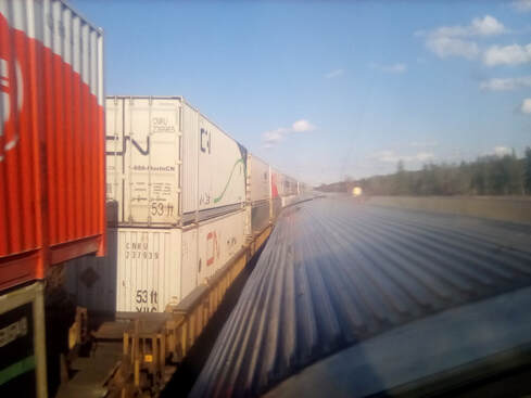
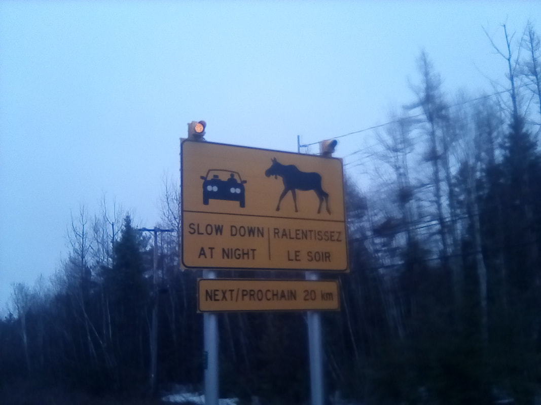
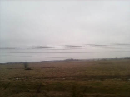
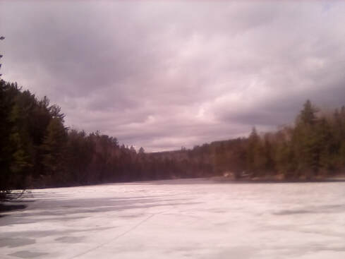
 The perfect snowy scene The perfect snowy scene Hello, all! Still on the train. Still in Ontario. Still snowing. We’ve now reset the clocks to Central Time, another hour behind, although we’re still in Ontario. We’re now six hours behind the UK. It was incredibly hot down in the train so I headed up to the dome where I watched endless snowy trees and frozen lakes pass by. Mostly, I was working on typing up my blog on my tablet (much slower than using a computer) but I happened to look up at just the right time to notice, walking around an icy lake, a black bear!!!! The train had passed before I could get a picture, but I was still happy, I’ve now seen a bear! Now I just needed to see a moose, a wolf and a racoon. My success rate has not been high. Well, the day continued to pass as it had yesterday – trees, lakes, snow, ice, the odd animal (but alas no more bears) – until we reached Sioux Lookout around midday. This little town was less exciting than its name suggests, but it was all the reason I needed to get out the train, which was getting quite stuffy, to go for a walk. This was a stop to refuel the train which I’m pretty sure does run on petrol or diesel. We were back in the carriage and ready to go in fifteen minutes. 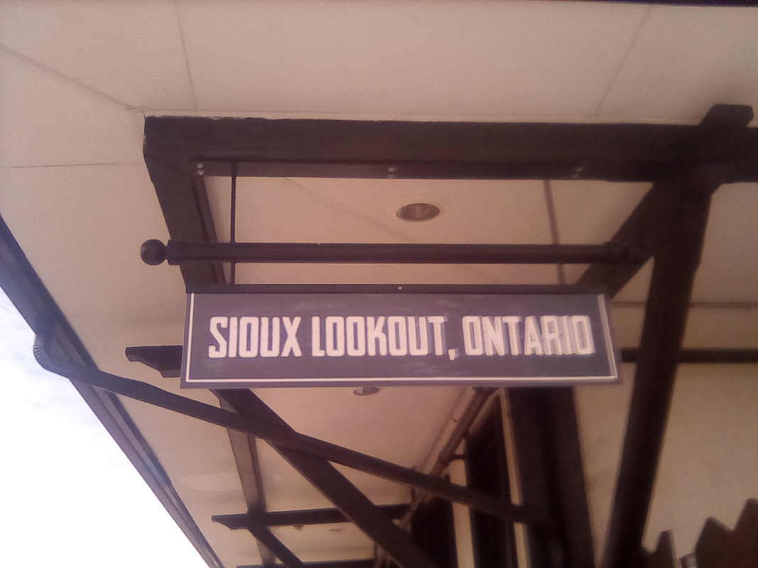 I had such high hopes for this place 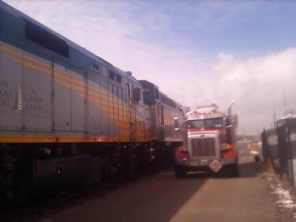 Refueling at the station Refueling at the station After this I played checkers with my train neighbour for a bit, but then it was back to writing up the blog and enjoying the views. Some time after lunch, the snow began to clear from the ground, although we continued to see frozen lakes for a long time after. At one point we passed what was either a very long lake or fairly wide river, bordered by trees, so, so many trees. There are more trees in Canada than I have ever seen in my life and they are spectacular. The train is slightly behind schedule, something I’m sure isn’t helped by the snow and that we have to keep stopping on side tracks to let freight trains pass. These trains are immensely long, I wouldn’t be surprised if they were over a hundred wagons long, carrying shipping containers, oil cylinders and what seem to be empty trucks. There’s even a freight train passing us right now. I’ve spent quite a lot of the day up in the dome, the views are just that little more spectacular here. Then, suddenly, just after dinner, the vast forests ended! Now there are farmed fields, maybe not quite prairie country yet, but close. In fact, I think we’ve made it into Manitoba. The train announcer just informed us we’re an hour out of Winnipeg just after passing the little town of Erma. As Winnipeg seems to be a little over 100km from the border, I say that means we’re in Manitoba.
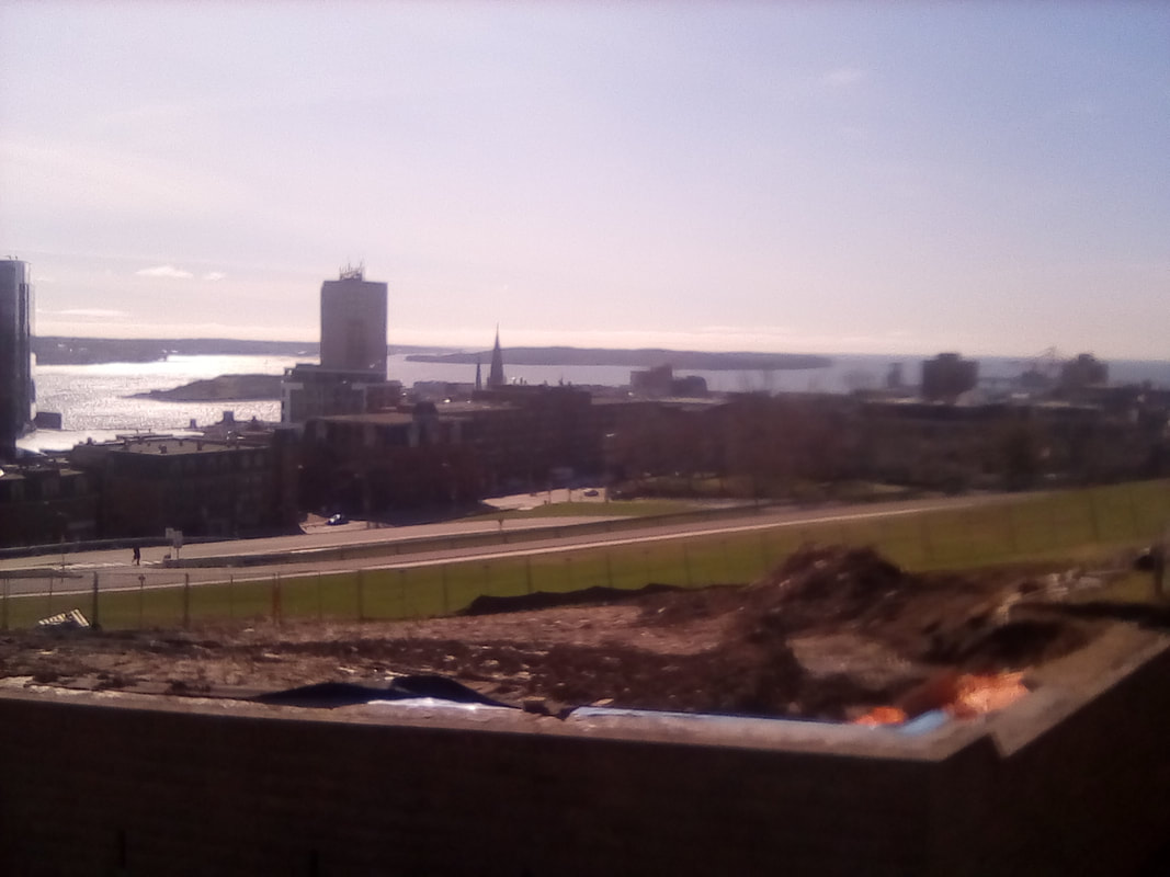
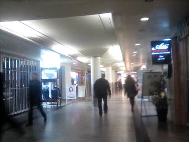
 The view behind The view behind So now seems a logical time to tell you what I’ve learnt about Ontario. After Québec, it’s the second largest province and this train has just crossed it at its longest point. This province borders the US and cradles Hudson Bay. As I’ve learnt, most of its lower part is lakes and forests. We’ve passed many lakes including Georgian Bay, Lake Nipigon and Lac Seul. There’s a London, Ontario as well as a Peterborough and a Perth, but otherwise the British place names of the major towns seem less common than in Nova Scotia and New Brunswick. It’s also the province of Ottawa, Canada’s capital and the home of the Hudson’s Bay Company, founded in the 1670s and the Group of Seven, artists who revolutionised Canadian art in the 1920s. And of course, maple forests. Toronto was once a colonial town in the British empire days, today it’s Canada’s biggest city. Niagara Falls is also the country’s biggest tourist destination. It’s also bear country as I’ve seen first hand. All this might seem like Ontario has more than its fair share of amazing sights, but it’s sheer size probably helps it gain a monopoly. Despite its size, there was something particularly fascinating about Toronto that I can’t explain. Maybe it was the huge height of the skyscrapers or the stunning view of the city from the CN Tower. Maybe it was the wonderfully laid out grid system, or how easy it was to navigate the subway. As much as I did love Toronto, the concrete and glass simply paled in to insignificance compared to the vast and seemingly endless beauty of the Great Lakes. There is nothing to compare it to, I could, and genuinely did, watch the view for hours without getting bored. Every tree was different, every lake and rock, the surprise of the black bear. The vast emptiness of the place, only occasionally interrupted by power lines and the odd tiny town. Like Niagara Falls, words simply can’t do it justice, you’ll just have to visit for yourselves, and take the train, it’s the only way to do it. 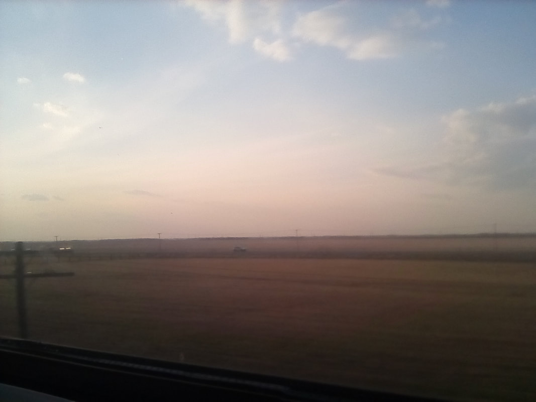 Sunset in Prairie Country 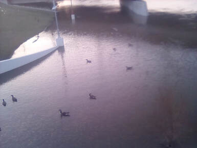 Canada geese Canada geese Not long after the fields started, the trees were back, but not as many and these seemed to be monocultures again. After that, the fields started to get larger as we moved closer to prairie country. The train arrived in Winnipeg nearly an hour late and as it was due to leave at 9:30pm as scheduled, this meant I’d only have forty minutes in the city as reboarding started at 9:10. I set off with one of my fellow passengers in the direction of the Red River. We crossed it via a funky bridge and stood at Provencher Boulevard, the main road into St Boniface, which is Canada’s second largest French speaking community outside Québec. I'd forgotten this was the way to St Boniface until I saw a billboard all written in French and the street signs were bilingual again. We didn’t spend long here as our time was limited, but this historic area has been here since 1818 when priests founded it to care for the Métis. The Métis of Central Canada are Aboriginal-French, semi nomadic and resisted integration, rebelling twice against the country’s unification. Originally they were given no land rights but as of 2017, talks were beginning with the government so this might change. After our brief visit to St Boniface, we crossed back to downtown and headed over to the Forks Market. I was looking for a carton of soya milk or juice but it quickly became clear this was not the place to find it. This was take out food and souvenir and shopping stores. Well, it was a cool market and would have been fun to explore it some more. On the way back to the station we found a lit up Winnipeg sign and the chance to pose for a photo. The Forks Market is so called because it’s in the Forks National Historic Site (although I think the oldest thing I saw was a skate park) and I believe the site got its name from its location at the confluence of the Red River and the Assiniboine River. We made it back to the station ready to board when we found out that the train was delayed, there was a problem with the toilets. Great... In the end, it wasn’t too late boarding but as of 10:27, we’re still waiting to leave. 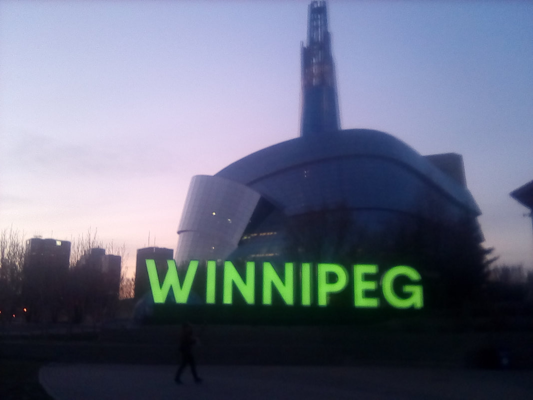 Well, my camera doesn't have amazing night vision 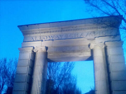 An archway, somewhere in Winnipeg An archway, somewhere in Winnipeg As it’s all dark outside and we’ll be in Saskatchewan in the morning, I’ll tell you now what I’ve learnt about Manitoba. Like Saskatchewan and parts of Alberta – the prairie provinces – this flat land was once the realm of buffalo, but hunting them almost to extinction in the 19th century all but destroyed the First Nation's way of life. This lead to prairie country becoming the producer of grain, oil and gas. Winnipeg is geographically in the very centre of Canada and half of Manitoba's population live in this one city. First Nations have lived here for over 6,000 years, but after the 1880s, grain going west became the principal export, leading to the formation of the Grain Exchange. Manitoba is also the home of Lake Winnipeg which seemingly covered most of the south of the province. I’m disappointed I didn’t get to see the Lake but time restraints! On the shore of the lake is the town of Gimli (one for you Lord of the Rings fans), home to the largest Icelandic community outside of Iceland. Arriving in 1875, the Icelanders proclaimed an independent state which lasted until 1897. There’s even an annual Viking festival which I’d love to see – I’ve become very interested in Viking and Norse mythology since visiting Iceland, as may have been mentioned in previous Editions. Well, it’s now 10:42pm and the train still isn’t moving so I’m going to call it a night. At some point when the train is moving, I’m going to go up in the dome and watch the stars, but now we’re in the station which has a roof over the train. Then I fell asleep and awoke to find the train moving finally at 2:15am nearly five hours behind schedule. I watched the city lights pass the train and promptly fell asleep again. I didn’t get to see any stars through the dome or otherwise. Onwards to Saskatoon! Until then, folks Charlie 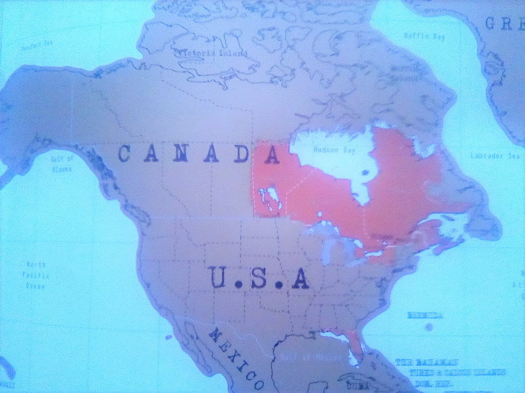 Province 5: Manitoba
0 Comments
 Ontario before the Great Lakes started Ontario before the Great Lakes started Hello, all! I’m on a train. For thirty five hours. The day started with breakfast provided by the hostel which I was very happy about. Having missed breakfast yesterday as I had to leave for Niagara Falls before it opened at 8am, I wanted to make the most of it, but with limited time, I only fitted in two slices of peanut butter on toast and an apple for the train. One thing I have noticed in Canada is food seems to have more ingredients. Ritz crackers which I remember as having about five ingredients in the UK, seem to have tonnes here. In the UK, peanut butter has at most four ingredients, here there were several lines of it on the packaging. The same is true for bread and soya milk. Still, they all taste good, the soya milk I particularly like. Now I’m on the train and once we’d left Toronto behind, Ontario is just trees and lakes. These trees are different to the trees of New Brunswick and Nova Scotia, more evergreen and more a mix of trees, suggesting these forests are more natural than the farmed monocultures of the east. Great rocks also break up the trees. And the lakes, what can I say about them? This is the Great Lakes region and they are truly great. Some so large I couldn’t see the other side look like the sea, some more modest ones are bordered by trees and lake-side houses. The views are spectacular, even through the slight rain. Well, as I was eating out last night, the news was on and it did promise more rain. Large parts of southern New Brunswick, south Québec and I think parts of Ontario are currently suffering severe flooding, from this winter’s extra snow and the heavy rain. So far it hasn’t affected the trains but it has caused higher water levels of the lakes and rivers.
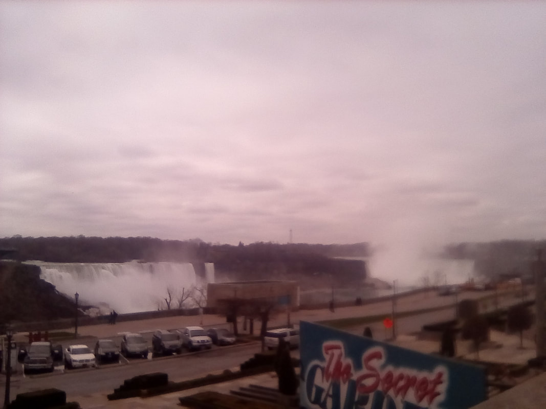
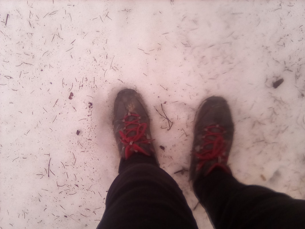
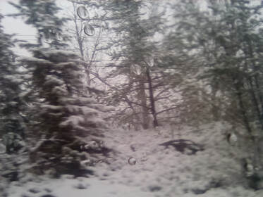
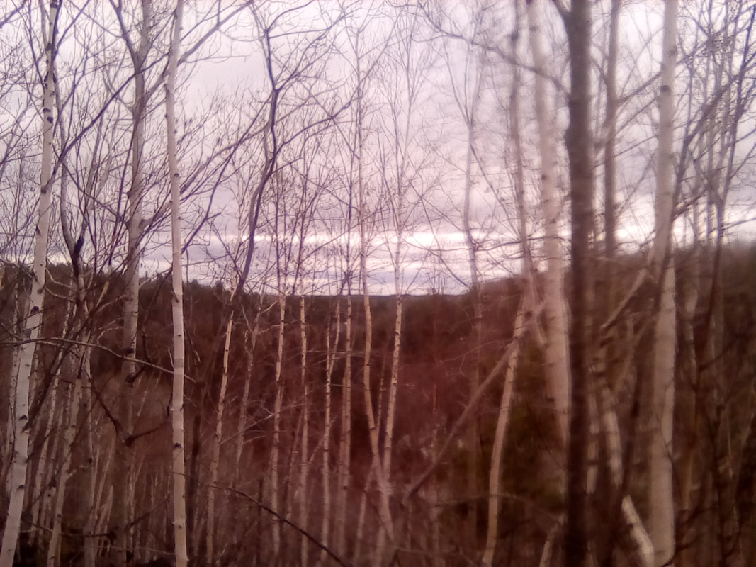
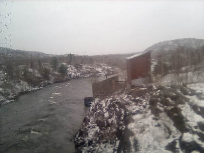 Here comes the snow Here comes the snow We’ve just passed Parry’s Sound, population 6,000, which an announcer on the train told us was a winter stop over point during the British empire days and is named after Edward Parry. It also has pink granite. I think all those things are true, I couldn’t hear the announcement too well. Well, when it stops raining, I think I’ll go check out the dome – the observation carriage. However my dome viewing plans were scuppered as not long later it began to snow quite a lot. In May. Welcome to Ontario! There was already some snow on the ground but when it started to fall, it coated everything a fresh. The trees became coated in a thick layer of snow and soon it began to look like mid-winter, not spring. That was when I went to have a look at the view from the dome – what I could see anyway. As it was still snowing and all there was to see was trees, the view wasn’t that different from downstairs and as it was cold in the dome, I headed back to my seat. 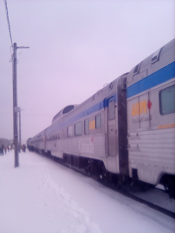 Snowy train 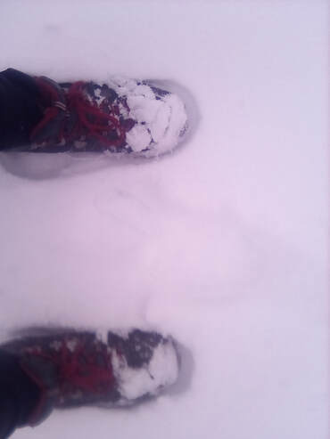 This is May... This is May... Eventually the train stopped and we were able to get off for fifteen minutes. Walking around in snow that covered the toes off my boots yet still being warm was quite special. We were near a small lake as well so these views were equally good. Then it was back on the train for dinner and to eat the giant cookie I bought yesterday. This cookie truly was the size of my face and I fully believe the claim it weighed half a pound. Needless to say, I ate all of it and thoroughly enjoyed it! It was dark now, so not long after that it was time for bed. I’d learnt from my last night train. This time I got out my sleeping bag and while it was too hot to get in it properly, I made a great nest out of it. Well, that seems quite a short entry for today but I have just been sitting on a train. I would tell you what I’ve learnt about Ontario, but as I’m not even close to leaving it, that should probably be saved for tomorrow. Yes, tomorrow I continue this marathon train journey onto Winnipeg then get back on the train and continue to Saskatoon. Until then, folks, Charlie 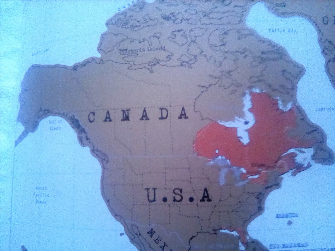 Province 4: Ontario 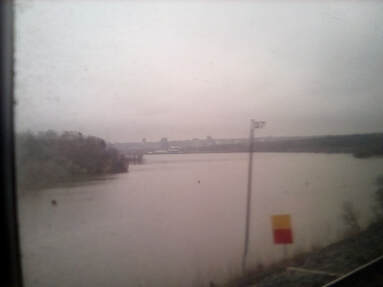 More water, but not the ocean... More water, but not the ocean... Hello, all! Today was split between visiting the amazing Niagara Falls and exploring the city of Toronto. It was another early start today as I caught the subway back into the city and took the 8:20am train to Niagara Falls – the earliest train of the day. I made it to the station but forgot what a long walk it was from Union subway to Union station. After joining the end of a very long queue, I was finally able to board the train which goes all the way to New York City. The two hour train journey took us much further away from Lake Ontario than I expected, meaning I didn’t get to see it at all. When the train arrived at Niagara Falls, the town, the crew had to change first, the Canadian crew getting off and the American crew taking over as the train would cross the border from Niagara Falls, Ontario to Niagara Falls, New York. When the crew had changed, we were allowed into Niagara Falls. My first impression of the town was that it was rather run down, in fact the Hotel Europa opposite the station was long since boarded up. There were some fancy metal arches over the roads with street names on them, but otherwise there was a lot of peeling paint and run down shops. However, once I got to the Niagara River and followed it upstream to the Falls, things started to get smarter. The large houses and BnBs along River Road were very fancy, even if the river itself seemed quite green and on the surface at least seemed not to be flowing. I followed the river all the way to the Rainbow Bridge, where I got my first glimpse of the American Falls and then the mighty Horseshoe Falls – that’s the famous one every body take pictures of. There was also the tiny Bridal Veil Falls although from this angle it was obscured by the American Falls. 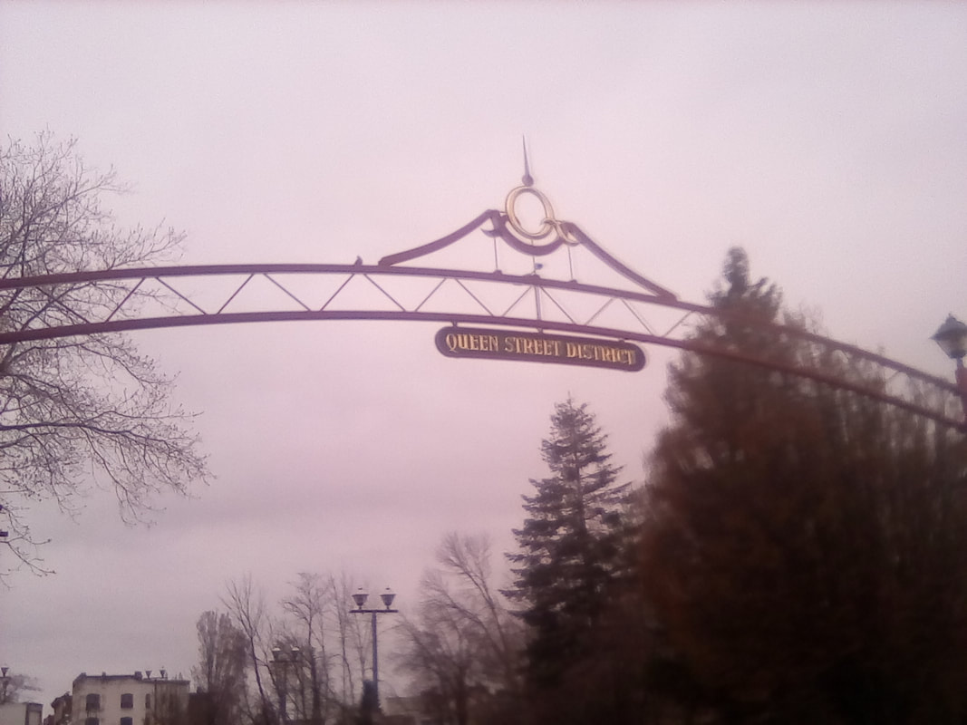 Welcome to Niagara Falls 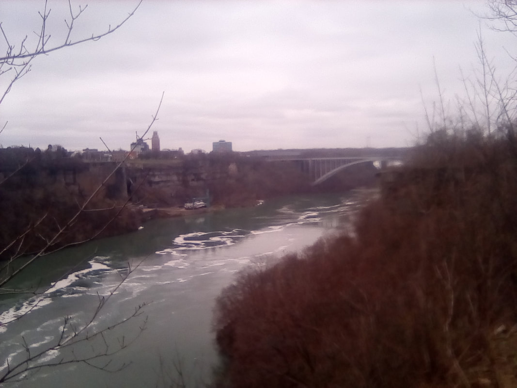 The mighty Niagara River 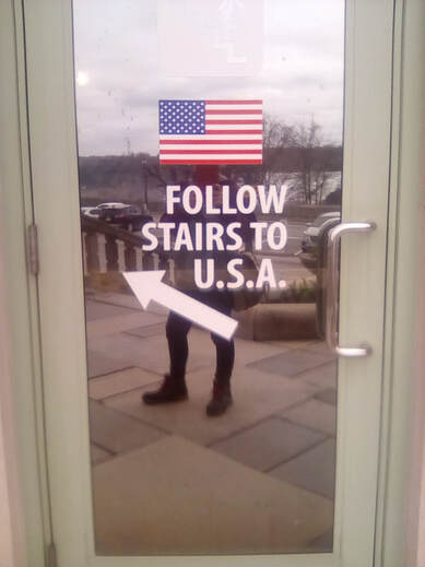 New York, here I come New York, here I come Then I walked across the Rainbow Bridge, so called because on sunny days, unlike today, rainbows can be seen in the spray from the Falls. This bridge allowed me to cross from Ontario into New York, a process which despite my research into the subject turned out to be much easier than I had thought. Turns out, to cross the Canadian-US border, all you need is $1CAN in quarters, a valid passport, an eSTA (filled out online already) and $6US. The Canadian dollar was to pay the toll to cross the bridge, I’m not entirely sure what the US dollars were for. Although I had to give my finger prints, I didn’t have to give my Facebook password and the customs check was done in all of five minutes. Immediately on the New York side, there was a Hard Rock Café, one stood in a similar position on the Ontario side. I’ve become quite a fan of the Hard Rock Café, but with only four hours (minus the half hour I had taken to reach the Falls) until my return by bus, there wasn’t time for a drink. Instead I headed straight to the American side of the Falls. I reached the smaller American Falls first, smaller but still 260m wide and 54m tall. After a few selfies it was a walk up the Niagara River to the Goat Island bridge. On the valley after the Falls, the water may have appeared to move slowly, but here it was almost at ground level, fast running and clogged with fallen branches and the odd chunk of ice, presumably from somewhere in Lake Erie. The Falls connect Lake Erie to Lake Ontario, forming part of the Great Lakes, they’re connected by the St Lawrence River to the Hudson Bay, or the Atlantic, maybe both.
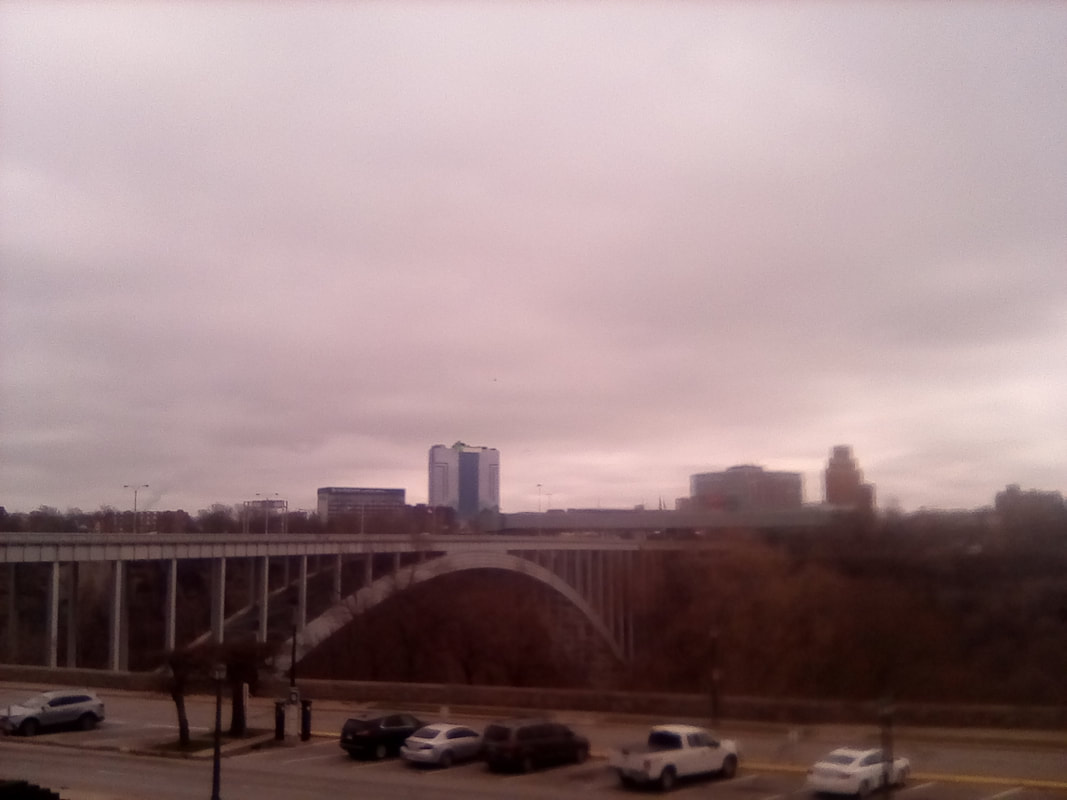
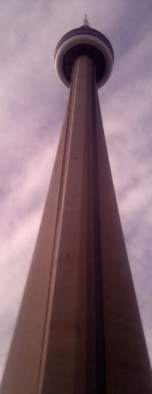
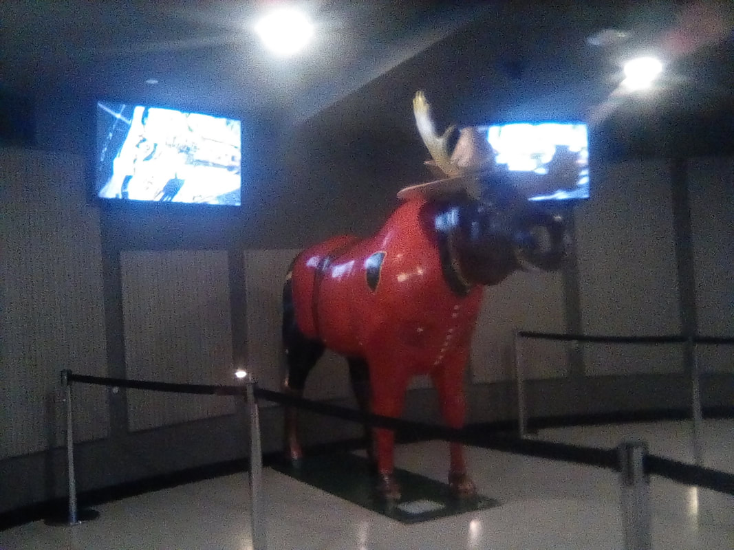
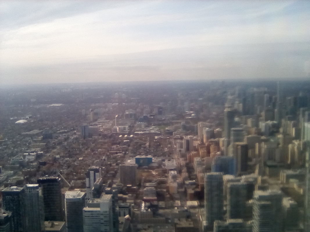
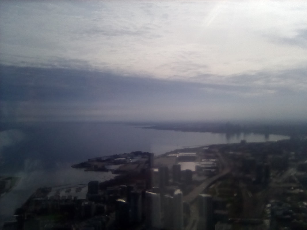
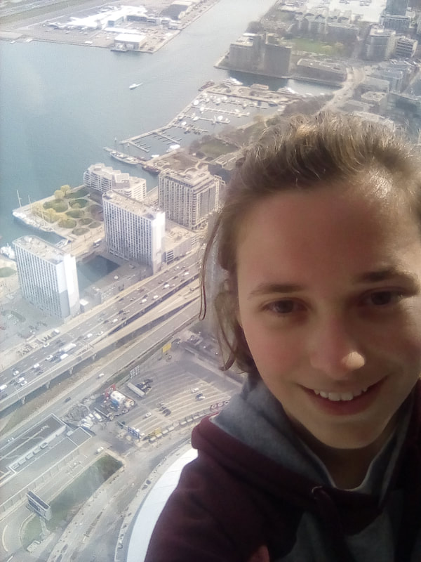
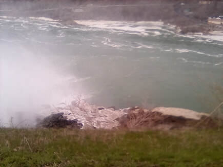 The River flows a bit faster this side of the Falls The River flows a bit faster this side of the Falls Apparently renovation work is heavy in New York this time of year as well. The Goat Island pedestrian bridge was closed so I had to take a longer route via the road bridge. This did mean, though, that I got to catch a glimpse of Lake Erie in the distance. I finally made it to Goat Island which separates the Niagara River creating the separate Falls. On the far side of the island was the Horseshoe Falls, named as it’s shaped that way. Both Falls are amazing, but this one was particularly special at 670m wide and 57m high. Spray was thrown into the air higher than the Falls and fell like rain on me even before I had got close to the Falls. Here was the opportunity for more selfies, while sort of getting rained on before heading around the Island's edge, where I could see the tiny Bridal Veil Falls separated from the American Falls by Luna Island, an island slightly lower than Goat Island, enough to give the Horseshoe Falls their extra three metres. I crossed back over the Rainbow Bridge, only having to show my passport and the visa waiver slip I had been given at my first crossing. 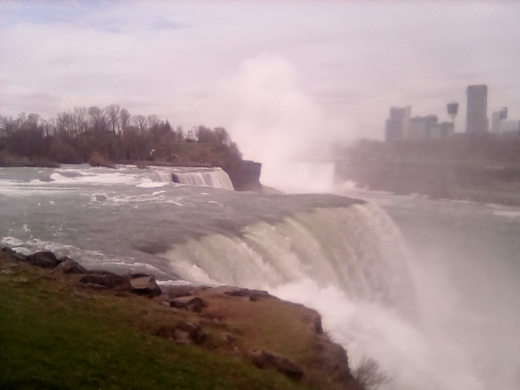 The American and Horseshoe Falls, from the New York side 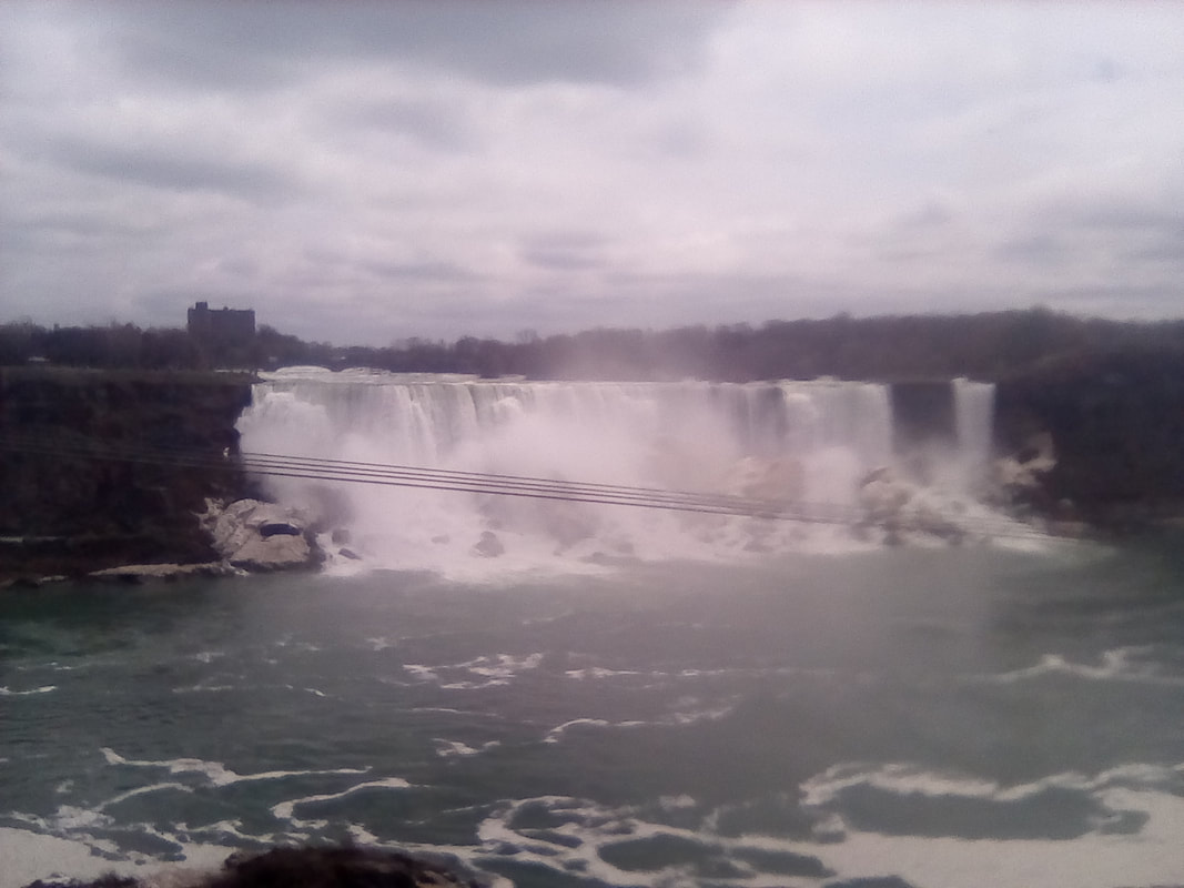 The American Falls from the Ontario side The American Falls from the Ontario side Back on the Canadian side of the border, I went to watch the Falls from the front. Even on the other side of the valley, I could still feel the spray from the Horseshoe Falls. The amount of water pouring over the rocks is a truly amazing sight, thoroughly earning it’s title of one of the seven natural wonders of the world. I could have stayed to watch much longer but I had a bus to catch. This time I walked upriver, back under the Rainbow Bridge to the dilapidated part of Niagara Falls. I would say this was the non-touristy part of town, but the train and bus stations were both here, lots of tourists pass through here, especially during the summer season. Anyway, I was a little early for the bus so I ate my lunch while waiting for it. Although it had only taken me two hours to get here this morning, this two hour train journey would be followed by an hour by train. Hmm... I slept for what felt like most of the journey but woke up in time to finally see Lake Ontario which was huge and truly magnificent. The bus crossed a bridge over the end of the Lake and soon we had arrived at Burlington. I would have had a forty minute wait here with nothing to do, but there was an earlier train that apparently I was allowed to get. No one ever checked my ticket anyway so I had nothing to worry about. 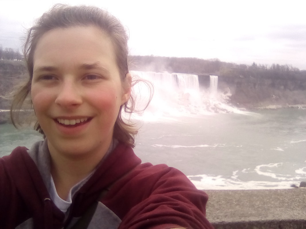 Me with the American Falls 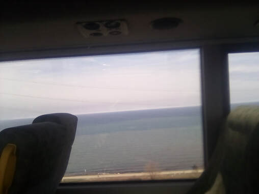 Lake Ontario! From the bus window Lake Ontario! From the bus window So, I’m on the train now, it’s a double decker train so naturally I headed upstairs for the best view. It’ll be some exploring of the city when I get back, the first time I’ve actually been outside above ground in Toronto, my hostel is in Scarborough. So, this train got me back into the city for 5pm. Channelling my inner cat, I headed for the tallest point in Toronto, the CN tower. I’ll be honest, I’m still not entirely sure what CN stands for but it could be Canada’s National. Anyway, this 553m tall tower was once the world's tallest building and still is the tallest in the western hemisphere. Its height no doubt contributed to the tower becoming a Toronto landmark. After fighting my way out of the station (everyone else was trying to get in) I made it to the tower, via the fancy old Fairmont Royal York Hotel. Opposite the tower was a collection of fancy old trains. I was all prepared to pay the $38 entrance fee, but I’d forgotten about tax. So in total it was $41.95. I think tax is about 13% but I'm not keen on it not being included in the price. So I paid my entrance fee and I was on my way up the tower. Just one floor at first for a photo with a green screen – so they could superimpose it over the view on a nice day – passed a moose statue and then to the lift to the top. Or should I say elevator? There are steps to the top, but these aren’t climbed for fun, usually for charity. So it was into the lift, which was glass sided so we could see the city falling away below us. There was also a glass window in the floor, presumably so we could see the inner workings of the lift. I was informed the lift moves at 22km/h and we were at the top in fifty eight seconds. Well, almost the top. The lookout pod was at 346m, but it still towers high above even the tallest skyscrapers. The views of the city were amazing and I got my guide book out to see what exactly I was seeing. I could see the parliament building and the Royal York Hotel. The Hotel had seemed pretty tall then, but now it was dwarfed. The cars and people far below were tiny and it was fascinating to watch them. To the south there were some pretty spectacular views of Lake Ontario as well. The pod also had a glass floor from which I could see all the way to the ground 342m below. As much as I love heights, I have to admit this was a nerve wracking experience! I had nothing to worry about though, the glass is strong enough to hold thirty five moose or 3,493 racoons. A whole host of other Canadian animals were recorded on a board next to the glass floor if you prefer your measurements in wolves, geese or polar bears.
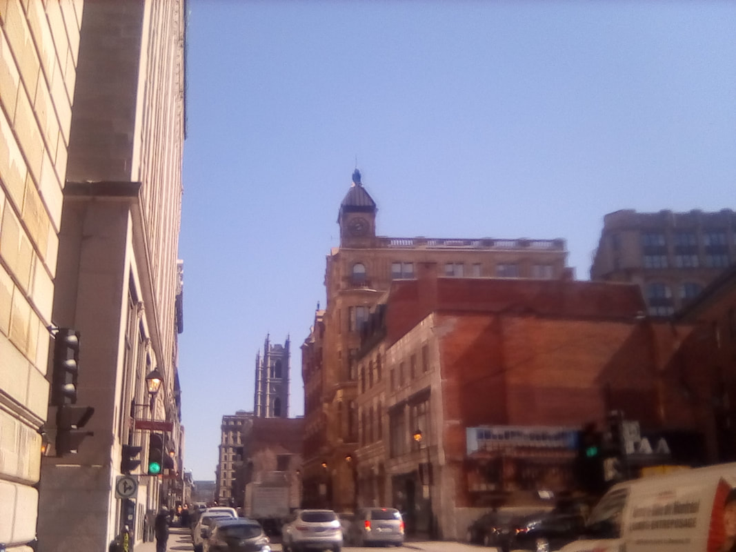
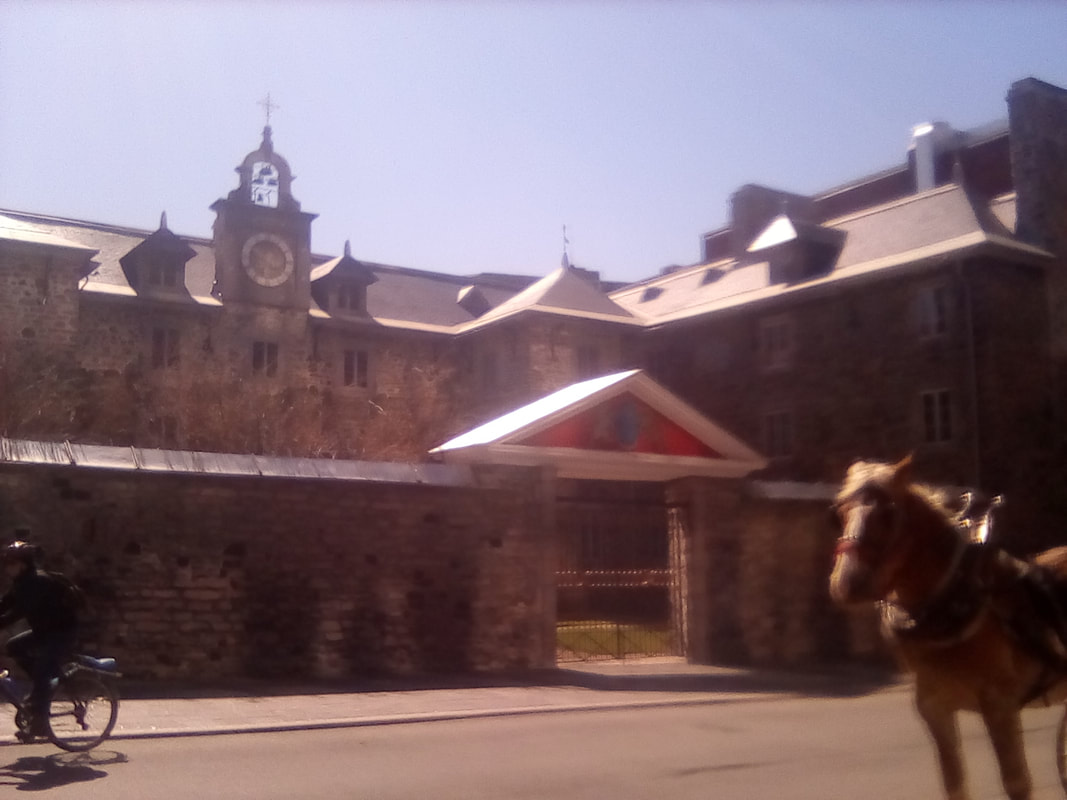
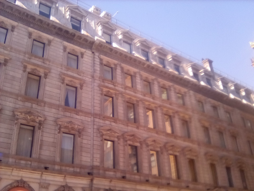
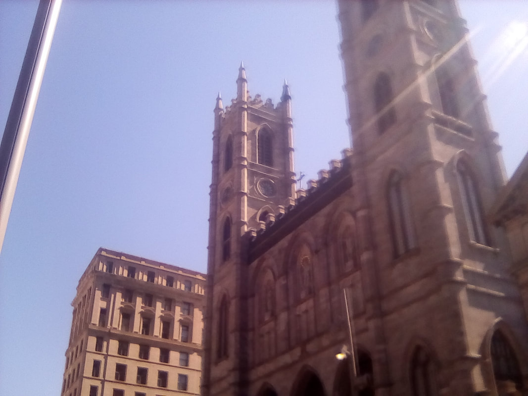
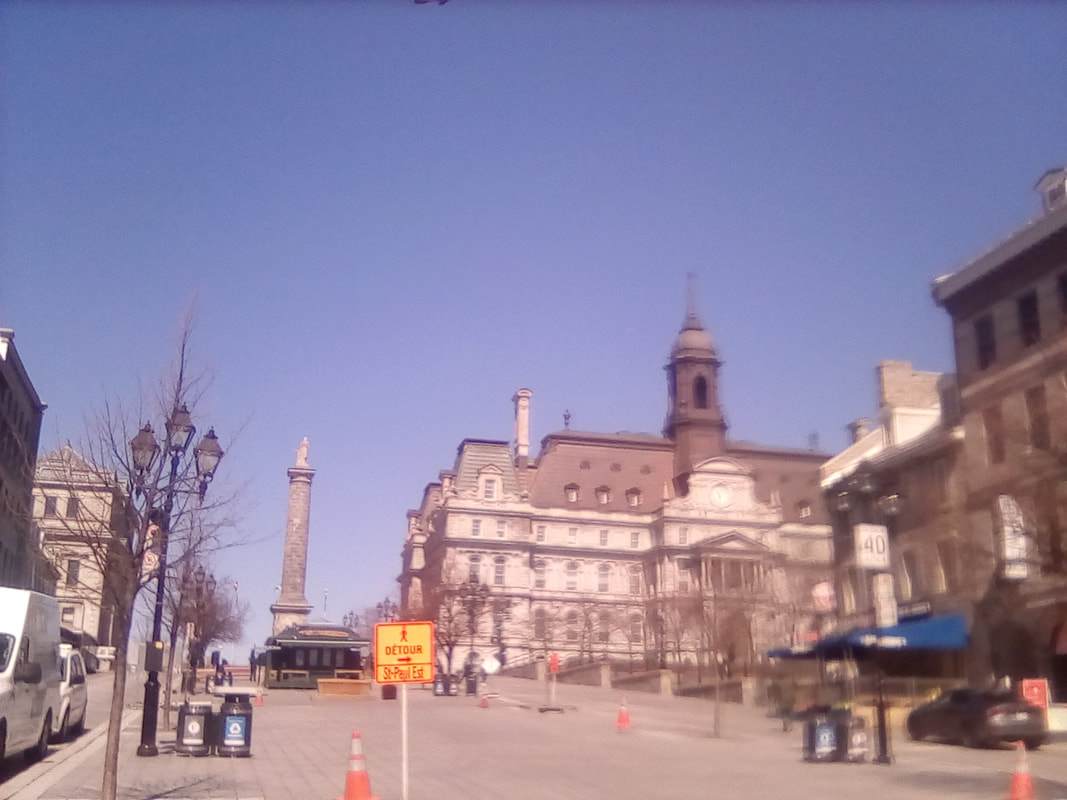
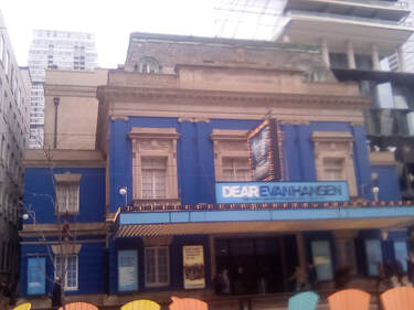 The Royal Alex The Royal Alex So, the glass didn’t break and I went back up to the main pod to enjoy the view one more time while planning where I’d go next. I decided that, at just after 6pm, it was time for dinner, so I took a walk there via the Royal Alexandra Theatre. Toronto is a city of some amazing tall skyscrapers, mixed with older stone towers and smaller buildings like the 'Royal Alex’. About to be bulldozed in the '60s, the building was saved by 'Honest Ed' and today plays and musicals are still hosted here. So, now it was onto dinner, the first time I’ve eaten out this trip which can only mean one thing – poutine!! This Canadian specialty is cheesy chips covered in gravy. I’ve had it once back in the UK and it was amazing so I came to dinner with high hopes. I found Copper Branch in a basement food hall and here I ordered a portabello mushroom burger and poutine. The burger was amazing, particularly the aioli sauce but of course it was really all about the poutine. This one was a Copper Branch special, the potato cut into cubes instead of chips, and the gravy was a mushroom sauce. It was still amazing and was a massive portion. I also got a cashew lime cheesecake for later which I can report was also amazing! Then it was a quick trip up the street a couple of blocks to Planta Burger, mostly just because I wanted a milkshake. I ordered a peanut butter and chocolate brownie milkshake then got distracted by a giant chocolate chip cookie. The cookie weighed half a pound and cost $5, what’s not to like? I bought it to eat on the train tomorrow. The milkshake was amazing with plenty of ice cream to make it thick. I was very happy. 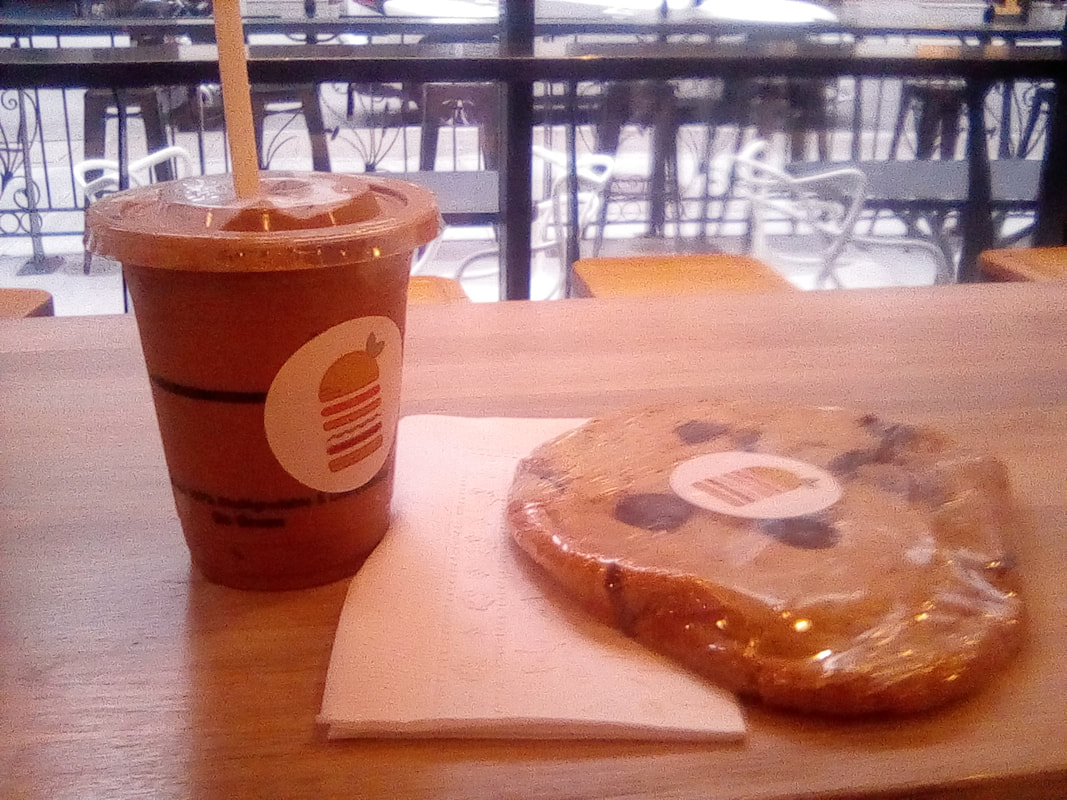 This was truly amazing. That's a big milkshake, which shows you how huge the cookie is! 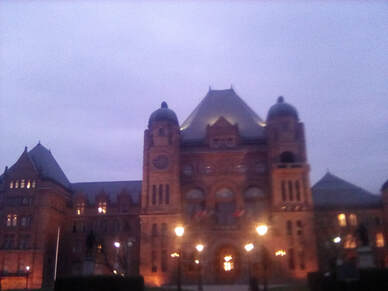 The Parliament Building, lit up for the night The Parliament Building, lit up for the night It was just starting to get dark so before the sun set, and because I hadn’t taken enough trips on the subway to pay for my day card ($13), I took the subway uptown to see the parliament building in its own garden. It was opened in 1893, when Ontario was but a small province, unlike now, where it is one of the largest. It’s made of limestone and apparently dinosaur fossils are visible in the stone on the inside of the building. Then it was back to the subway to City Hall, via a quick stop at the first Canadian supermarket I’ve visited (ok so it was more like a local) to buy some soya milk. As it turned out, the smallest quantity they sold was the very precise 1.89l. It seemed to cost $4.49 but when I got to the self service check out (which is almost the same as in the UK), I was only charged $3.50 – excellent! And it seems soya milk is marginally cheaper here than in the UK. Which is good because other vegan products aside from the Ritz crackers seem lacking so far. I also realised at this point I had acquired a US quarter from somewhere – mysterious. Shopping done, I went on to check out City Hall, although it was fairly dark now. Or what I thought was City Hall anyway. The guide book tells me City Hall, built in the '60s, has huge glass towers and I didn’t see them. Well, whatever it was, it was a nice building. Well. That about sums up the day. I took the subway back to the hostel (I've really got the hang of the system) and got ready to spend the next few days on the train to Winnipeg. Until then, folks, Charlie  The city by night  Bonjour à tous! I'm in the French province. What an amazing day! It started very early as the train’s curtains weren’t very light proof. We were passing through the countryside of Québec Province, differentiated from Québec City, it was mostly open farmland, interspersed with some trees of course and large grain silos and the odd town. Or at least collections of houses. The train gave an excellent view of the city as we approached Montréal and we arrived after crossing a big green bridge right on time. This was by far the biggest station I’ve been in on my Canada trip so far, but it’s still smaller than most London stations. For a $6 fee, I could leave my giant hiking bag in storage and pick it up later. Believe me, it was worth every penny to not have to carry it around all day. Not that Canada uses pennies anymore, the cent has been removed from circulation and purchases are now rounded up or down to the nearest five cent, the smallest unit of currency. It was now time to head out into the city, following my trusty travel guide's supplied walking tour. I made my way to Rue Notre Dame via Victoria Square, walking passed the Basilique Notre Dame de Montréal then along Boulevard St Laurent, Rue St Paul and Place Jacques Cartier, admiring the architecture before rejoining the Rue Notre Dame to see Hôtel de Ville (City Hall) which may once have had a green roof but was now brown and Château Ramezay, once the city’s council building. I then took to the Rue St Claude to investigate the amazing architecture of the Marché Bonsecours, now a market, once Canada’s parliament building. Next door was the Chapel Notre Dame de Bonsecours, more fine architecture and from here it was a short walk to Vieux Port. This is Montréal's nineteenth century Old Port, once one of the most important North American harbours. Now there’s a pirate ship themed kid’s play area, but also amazing views of the St Lawrence River.
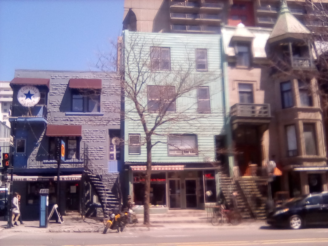
 This building was meant to have a green roof... 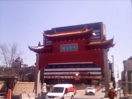 I wish I knew what the Chinese characters said I wish I knew what the Chinese characters said Back to the Rue Notre Dame, almost at its very end, was the Sir George-Etienne National Historic Site, the rather long winded place name houses lots of information about this influential French-Canadian politician (I think he might have been prime minister at one point), in the 1800s. Next it was on to the bustling Chinatown framed by pink pagodas at either entrance on Boulevard St Laurent. On Rue Clark, there is a garden named after Chinese leader Sun Yat-Sen, I’m rather disappointed it was closed, but there is another Sun Yat-Sen garden in Vancouver so hopefully that’ll be open. Then I trekked through the streets of Plateau Mont Royal, apparently the most Montréal-esque of all the city’s neighbourhoods. The houses and apartments were certainly very stylish away from the towering skyscrapers, the houses in an eclectic array of colours and styles. From here it was only a short walk to the Parc du Mont Royal, from which the district gets its name. En route I met a lovely Vancouverite, who noticed the Berlin patch on my bag and from here we struck up a conversation. She was visiting Toronto via Montréal, we had a great conversation about travel, took a few pictures together and then went our separate ways.
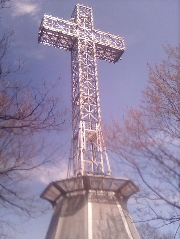
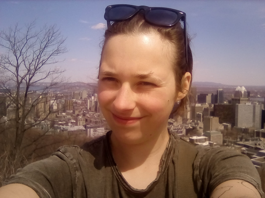
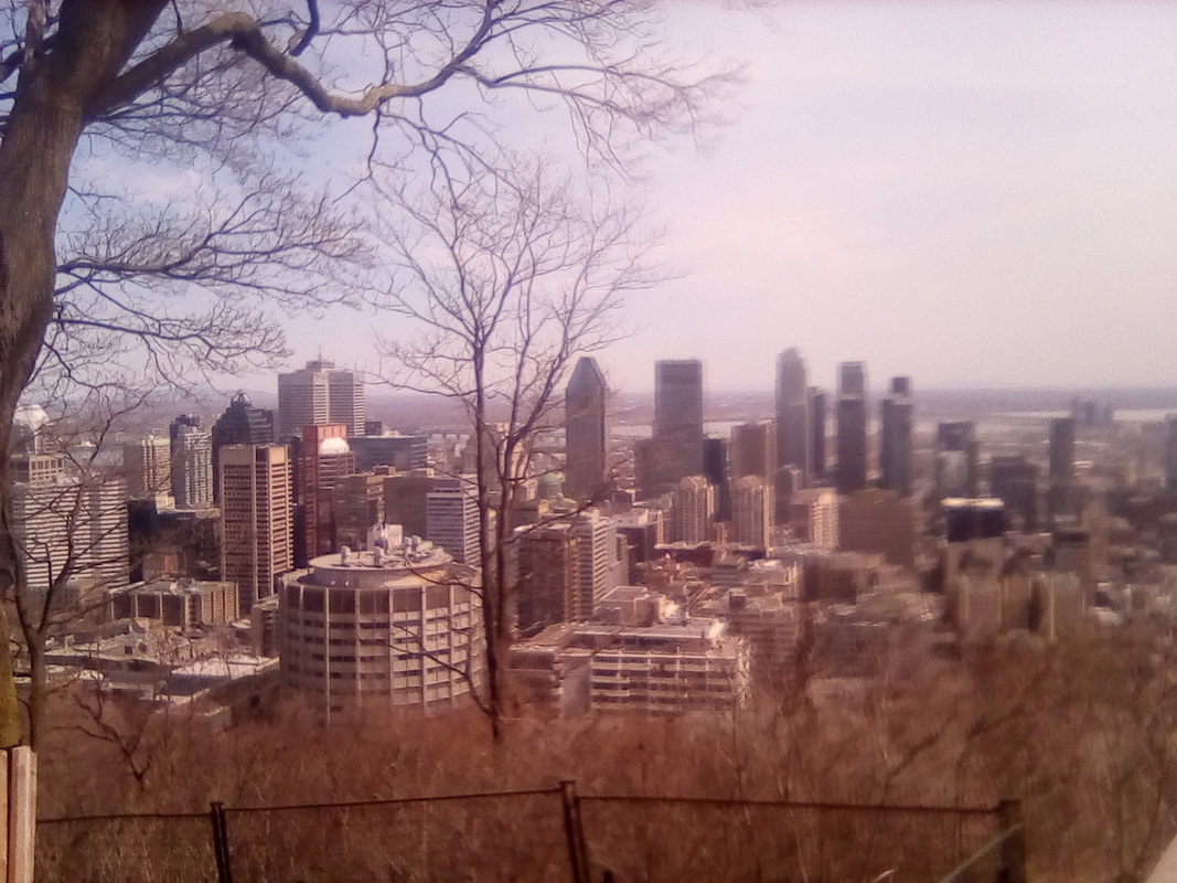
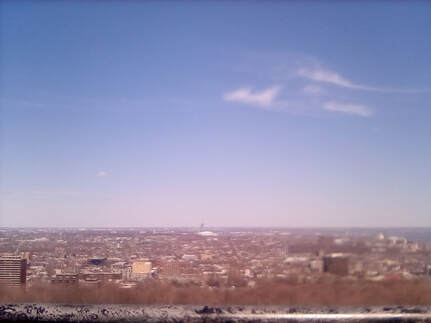 The north and east view The north and east view Although I knew it would be a hill – Montréalers call it la Montagne or the mountain – I hadn’t expected it to be quite so steep, my guide book does say it’s 234m tall, maybe I should have paid more attention to it. Anyway I climbed the slopes which in some places really were quite steep, to be surprised by a road almost at the top of the hill. There was even a shuttle bus, I didn’t realise la Montagne was so popular! I made it most of the way to the top at which point I was distracted by a panorama spot of the city north and east of the Parc. It was Jacques Cartier whose street we visited earlier who named the hill Mont Royal and from here the city got its name. In fact, the landscaping was done by Frederick Law Olmsted who designed Central Park in New York. After enjoying this view, I headed to the summit, marked by what appeared to be a phone mast, where I had lunch. The sun had come out perfectly and I was wearing a t-shirt and sunglasses by this point. After a relaxed lunch, I headed down the hill a little way to the cross, which for reasons I don’t understand is 30m tall and seemingly covered in light bulbs so I can only presume it is illuminated at night. A bit more down the hill and on the south side, facing downtown was the Chalet du Mont Royal pavilion, a viewing area in front of which gave spectacular views of downtown. I stood here a long time in what was clearly a tourist hotspot just looking at the city. Every time I looked on a different direction, I saw something new and spotted a few of the buildings I had visited earlier as well. Although an arrow pointed in the direction of the Hôtel de Ville, I couldn’t see it.
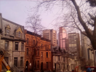 Onto the Golden Mile Onto the Golden Mile Having seen as much of the city as I could from above, I returned to street level. This time I walked along the blocks of Rue Sherbrooke Ouest (West) between Guy and University. This area is known as the Golden or Square Mile as it was where the city’s rich industrialists and traders built their houses in the 19th century when Montréal was an important part of the British empire, interspersed with more modern buildings. A few of these buildings still remain, including the Ritz Hotel (I don’t think it was the Ritz originally). With McGill University, which surprisingly was on Rue University, the Golden Square Mile ended although confusingly University became another street after Sherbrooke, but my so far trustworthy guide book claimed University ran all the way back to Notre Dame. Anyway I followed the street that wasn’t University along until I found Christ Church Cathedral which as cathedrals go seemed quite small and like most other places, including the roads surrounding Mont Royal, renovation was underway ahead of the summer season. It had a nice green roof though which actually was green unlike Hôtel de Ville. From the cathedral, I walked along the commercial Rue St Catherine Ouest to Square Dorchester and Place du Canada. Square Dorchester had been visibly reduced as this was also being renovated but Place du Canada, next to the fancy Cathédrale Marie-Reine-du-Mode, was whole. Besides Square Dorchester was the Sun Life Building, a building big enough to rival the cathedral and which housed the British crown jewels during WWII, seems like the Tower of London wasn’t safe enough for them. There was also a statue of Sir John A Macdonald, Canada’s first Prime Minister and a horse and soldier memorial to the Boer Wars, or the Wars in South Africa as the inscription read.
 Well, this isn't quite what I'd imagined Well, this isn't quite what I'd imagined From here it was onto the Underground City, a huge subterranean metropolis. Ok I know I’ve just used fancier words to describe it, but it grew from its humble beginnings as the city’s first Metro system in 1966. Now there are thirty kilometres of shopping malls under the city on multiple levels; shops, restaurants, cinemas, theatres and even an ice rink so Canadians can ice skate all year round – I’m pretty sure that can be achieved above ground too - it took a long time for me to find the City and only then after asking information. I’ll admit I was a little underwhelmed by it, mostly I think because it looked like every other shopping centre I’ve ever been in, just subterra. Still, I can’t complain, I suppose, I got a postcard souvenir and a carton of excellent mango juice. It was now time to return above ground to the station, the Underground City spans under this station and around the Peel, McGill and Bonaventure metro stations. I collected my bag and putting it back on, it seemed to be lighter than I remembered it. Well, it should be with all the food I’ve eaten. Then I boarded my third train and soon I was off to Toronto. In the tradition of British place names in Canada, we are currently stopped in Cornwall station. I’ll get into Toronto at 11:30 and then it’s half an hour by subway or whatever they call it there to my hostel, I’ll let you know later how that went.  The words to O Canada were carved into the wall at Montreal Station 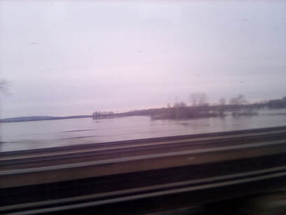 Onwards, passed more water that isn't the ocean Onwards, passed more water that isn't the ocean But as we’re speeding away from Montréal towards Kingston, Ontario, let me relate what I’ve learnt about Québec and Montréal. Montréal was founded as a religious city, yet today it’s reputation is for its night life. Most of the population have French roots, but the majority of people are bilingual at least. Québec is both Canada’s largest province and the biggest French speaking area in the world. Québec has twice held a referendum for independence but both times it was close with the population voting to remain. Unlike Halifax and Miramichi in bilingual provinces, the majority of signs in Montréal are French only. While train announcements are still bilingual, French comes first in Québec, whereas it was English in Nova Scotia and New Brunswick. I have been informed French becomes less widely spoken further west, I’ll see how true that holds. Well, it was quite dark when I arrived in Toronto, it being 11:30pm. I just wanted to go to bed. I took the number 1 then the number 2 subway where I got off two minutes from my hostel. Here I was in the British Columbia room appropriately enough. All the rooms are named after provinces in this hostel which I really like. I fell asleep almost straight away. Tomorrow I’m off to Niagara Falls!! Until then, folks, Charlie  Province 3: Québec 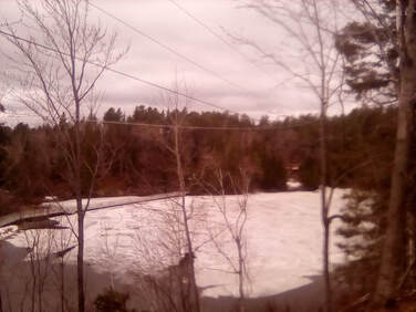 Snow!!! In April Snow!!! In April Hello all! Today has been the most amazing day! I started the day with a relaxing morning getting ready to check out at noon and start the long two and a half hour trek back to the station with my giant hiking bag via French Fort Cove. Just as I was ready to leave, my fantastic hosts invited me to dinner and offered to drive me to the Cove and the station this evening. This meant that not only did I get a hot meal, my first in Canada, I also didn’t have to trek around with the giant hiking bag and got to enjoy a relaxing meal with my hosts. So, after having repacked a small bag for the day, we set off to the Cove. French Fort Cove is so called because when the Arcadians were expelled by the British in 1755, a Quebecois 'adventurer and soldier' made Beaubear's Island just up river of here a refuge for the Arcadians and the cove area a defensive fort. This adventurer was called Charles Dechamps de Boishébert of which Beaubear’s is a corruption. However. The cove is much older than this, the original inhabitants were the Mi'kmaq, first arriving three thousand years ago. After the Arcadian expulsion, a Scottish entrepreneur was granted a lot of money by the British crown to establish a British presence here. This was done by setting up a fishery; a lumber mill, grind mill and shipyard followed. Then Charles Fish built a quarry. Now the area is a nature area, full of hiking and biking trails, one of which is named Fish Quarry Loop. There were also signs warning of the presence of bears. I didn’t see any (nor have I seen any moose yet for that matter), which I am a little disappointed about, though how I would have reacted if I had seen one, I don’t know. With a few hours until I'd be picked up for dinner, I set off along Fish Quarry Loop, a trail which stayed close to the stream. Not far into this trail, the Creaghan Gulch Loop began. I had intended to stay on the Fishy Loop, but quickly changed my mind and I’m glad I did. The path climbed higher, away from the water, up towards the top of the valley sides. The trees which shielded most of the view of the Creek fell away and after passing a zombie warning sign (I don’t know), I reached a rocky outcrop with an amazing panorama of the valley. The view was so amazing, I decided to stop there for lunch, periodically turning around to enjoy the view from all angles.
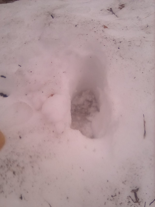
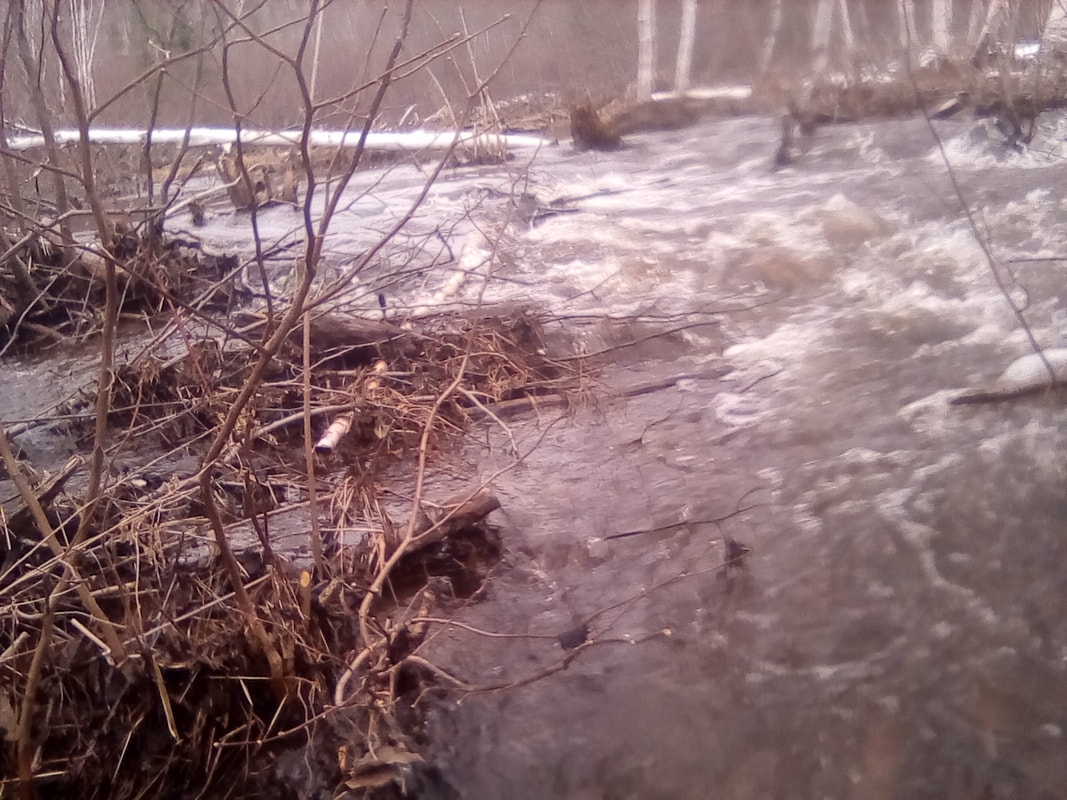
 Sometimes I feel like I can't see the wood for the trees... 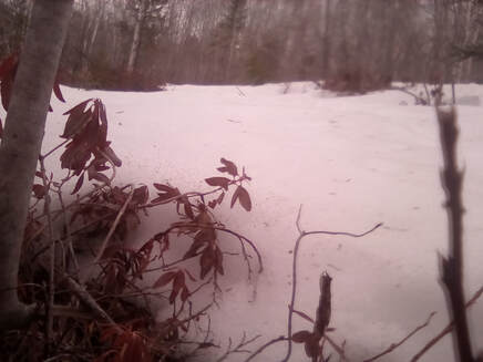 The snow started to get very deep here The snow started to get very deep here Although considerably warmer than yesterday, it was exposed up here and so quite windy (as well as there still being snow on the ground). So I set off walking again soon after I’d finished eating. Although there had been some snow on the ground on the rest of the route, it started to get deeper as I walked further. In places it was so deep snow came up to my mid-shins and I had to keep scraping snow out of my boots. However, I wasn’t very successful at this, soon my feet were quite wet. It was worth it for the views though as I got higher up and the trees continued to thin and I could see more of the valley. I continued through the snow until I reached the start of another trail. I started off on this third trail, but soon the snow became so deep and covered the entire path, so I decided it would be sensible to retrace my steps (literally standing in the footsteps I made earlier) and rejoined the Creaghan Gulch Loop. Initially, this path was quite well maintained. Then it disappeared a little, before returning just before it reached the river. 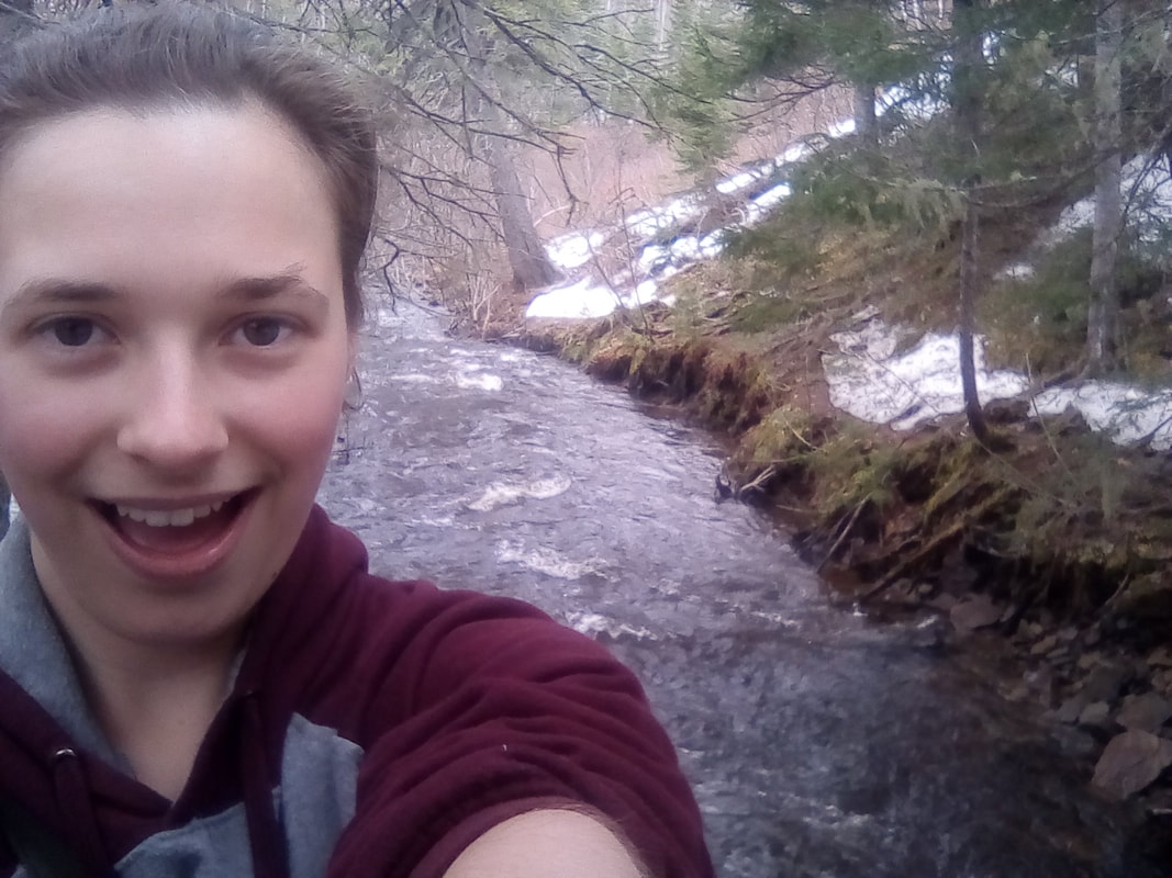 Apparently I was very excited about standing on the precarious bridge over the river 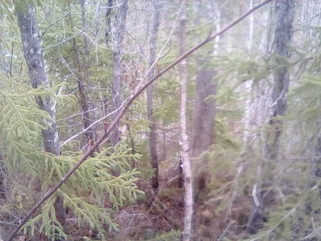 So I climbed this, that silvery thing in the middle of the trees is the river So I climbed this, that silvery thing in the middle of the trees is the river It was a rather precarious looking bridge, built very low to the water and slightly collapsed in places. It was probably so close to the water as, after an exceptionally long winter, snow starting in late October rather than early December, and totalling ten feet, there was a lot of snow to melt. As such, it was all flowing into the Creek and on to the Miramichi. I made it safely over the bridge and discovered the path was completely snowed under. Not knowing where it was, but just about being able to see where it reappeared at the top of the valley, I was left with two choices, retrace my steps or climb the bank. The first option seemed like quitting and so I summoned my inner cat and began to climb. There were plenty of trees to hold onto and I made it up the bank without losing my tiny wireless earphone or falling back into the Creek which would probably have been worse than losing a headphone. Back on the path, I found where it should have brought me up from the river and continued walking. After this, things were a bit easier, I rejoined the Fish Quarry Loop but not before taking a little detour over an even more precarious bridge over a wide part of the Creek. Here several weirs flowed under the bridge, splashing against it. This spot produced some fantastic pictures, but I don’t think the view and sheer scale of the place can ever be properly captured in photos. You’ll just have to visit for yourselves. From here I then returned to the original trail, this time walking up a bridge to discover the path entirely covered in snow. Here it was flat ground so not much of a problem, but soon the path started to lead up the valley sides. Here I met a couple of walkers who promised me it was snow all the way out. And they were right. After using a helpful rope hand rail to haul myself up the path, I trekked through snow all the way back to the lake. The views continued to be amazing though so I can’t complain too much. There was a big metal bridge across the still partially frozen lake which also provided a great photo opportunity.
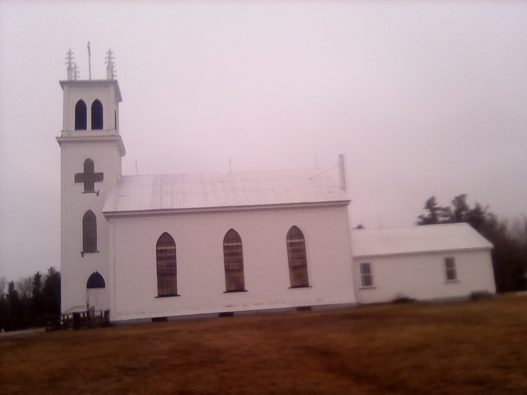
 The beauty of a frozen lake in April The beauty of a frozen lake in April Having made it back to the start of my trek, I sat down at several places along the lake to enjoy the views. With just over an hour until my host would pick me up, I decided to head back to my lunch spot for one last look at the view. It was absolutely worth it. I laid down on the big rock to keep out of the worst of the wind and took in the different trees, the valley and down to the Creek. The cove area was absolutely amazing, I highly recommend it! I then walked back to the car park (or parking lot as I suppose I should get used to calling it), via the Buckley Burner, a big brick chimney which is all that remains of the Buckley Lumberyard which burnt down in 1921. The sawmill followed in 1922. Now disused, the chimney is a town landmark. It was now time to head back to the AirBnB where my wonderful hosts had made me the best mushroom and barley soup I’ve ever tasted. It was completed with Ritz crackers, the only vegan crackers they had in the house. The meal was great, we chatted about veganism, Canada and the UK. I’ve learnt many useful Canada facts, some of which I’ll share later and was able to correct their pronunciation of Brexit, makes a change from needing my pronunciation corrected. Here, they were pronouncing it Bree-ex-it which amused me. After this fantastic meal. I finished the last of my packing and my hosts took me back to the station. They were both amazing, even sending me on my way with some fresh fruit, a nice change from the dried fruit I’d been eating so far. The apple was a New Brunswick special so I’ll report back on how it compares to a British apple. They’ll definitely be getting a five star review. 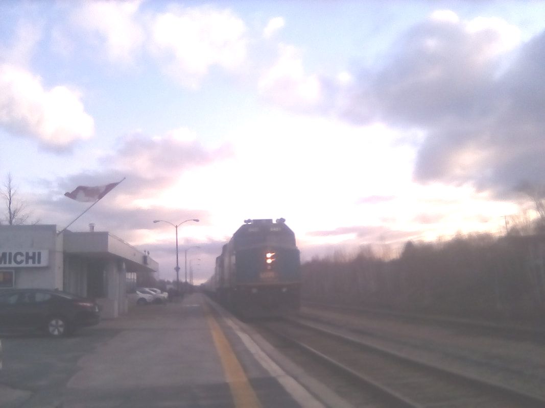 The train's arrival with dramatic lighting 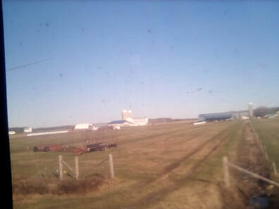 New Brunswick mostly looks like this New Brunswick mostly looks like this Soon, the train arrived, I boarded and took my last look at Miramichi, and I’ve just about learnt how to pronounce it properly. As I am now on the train to Montréal, Québec let me share with you what I’ve learnt about New Brunswick. Here, if someone asks 'how’s she going?’, the correct answer is 'the very best'. It’s also illegal to transport bees over the New Brunswick-Nova Scotia border. Now, this poses three very interesting questions, besides the most obvious, why? Firstly, who intentionally transports bees across province borders? Secondly, what if a bee happens to get caught in a car and transported across? And thirdly, bees have wings, what’s to stop them flying over the border? Miramichi is one of the least culturally diverse places in Canada, this country known for its diversity. The only religious buildings are churches, you can’t get Chinese food here, I doubt you could get a pizza. Moose walk across the highway, bears and racoons are regular visitors to my hosts' garden (or backyard, although as they’ve got land I think they just refer to it as their property). In Nova Scotia, people stopped what they were doing to watch the train pass, in such rural areas, if it wasn’t dark now, I guess New Brunswickers would too. Trains are rare here, in a Lord Beeching-esque series of cuts in the 1980s, many trains were lost, now only one train a day runs from Halifax to Montréal and I don’t think that happens every day. If I’m not mistaken, this train is the first train to have come through here since the one I arrived in Miramichi on. New Brunswick, Nova Scotia and Prince Edward Island have a large English, Scottish, Irish and French heritage, this being the first stop for many immigrants and make up the Maritime Provinces. Add Newfoundland and Labrador and they are known as the Atlantic Provinces. They all share a time zone, four hours behind the UK, except for Newfoundland which for reasons known only to Newfoundlanders, is three and a half hours behind. Also, New Brunswick Cortland apples are really good. Well, that’s about it for today. This is my first night train, I’ll wake up in the morning in Québec, maybe if I wake up early or after sunrise, I’ll see Québec City. Once again, I’m using food to reset my body clock as Québec is an hour behind the Maritimes. I find this a very strange concept, one country split into five different time zones. I’m sure I’ll get used to it. Until then, folks, Charlie 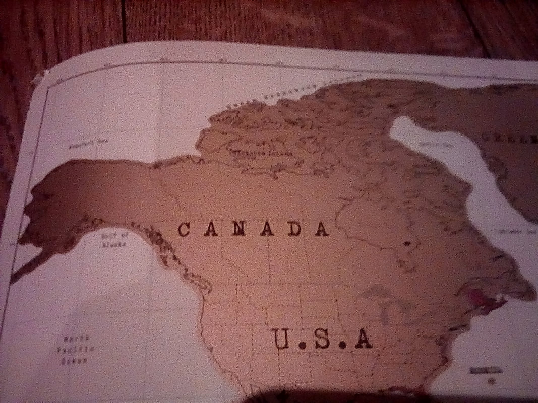 Province 2: New Brunswick 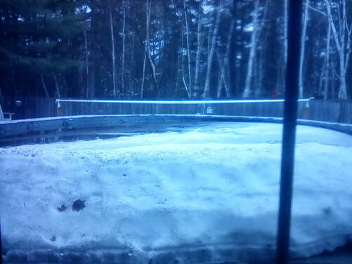 Lots of snow, but I could still go swimming... Lots of snow, but I could still go swimming... Hello, all! Today I got to explore Miramichi. I decided the best way to do this would be to walk along the King George Highway, a very long road which runs along the Miramichi River although not as close to the river as I had hoped! After ascertaining the pool outside my window hadn’t unfrozen overnight, I set off along the road, upriver. I trekked through Lower Newcastle and up to the Bartibog River, still marvelling at the size and style of the houses. Also, there were loads of pick up trucks here, as many as Halifax and many of them are Chevys which makes me indescribably happy. It was just over an hour and a half's walk from the AirBnB to the bridge over the river. Along the way I saw lots of trees and streams and tantalising views of the river. There was also another moose sign but sadly no moose. Hopefully I’ll find some soon, if not, I’m sure there will be some in the Rockies. Anyway, I made it to the river which flows into the Miramichi. Here there was a road which led down to the Miramichi so I got a good close up look and saw St Peter and Paul's church which was very white and wooden. I then headed back to the Bartibog Bridge, crossed it and clambered down to the river on what I’m sure wasn’t an official path. Even though this is only a tributary of the Miramichi, it was still huge, this is Canada after all. I sat almost under the bridge, just thinking about how big it was.
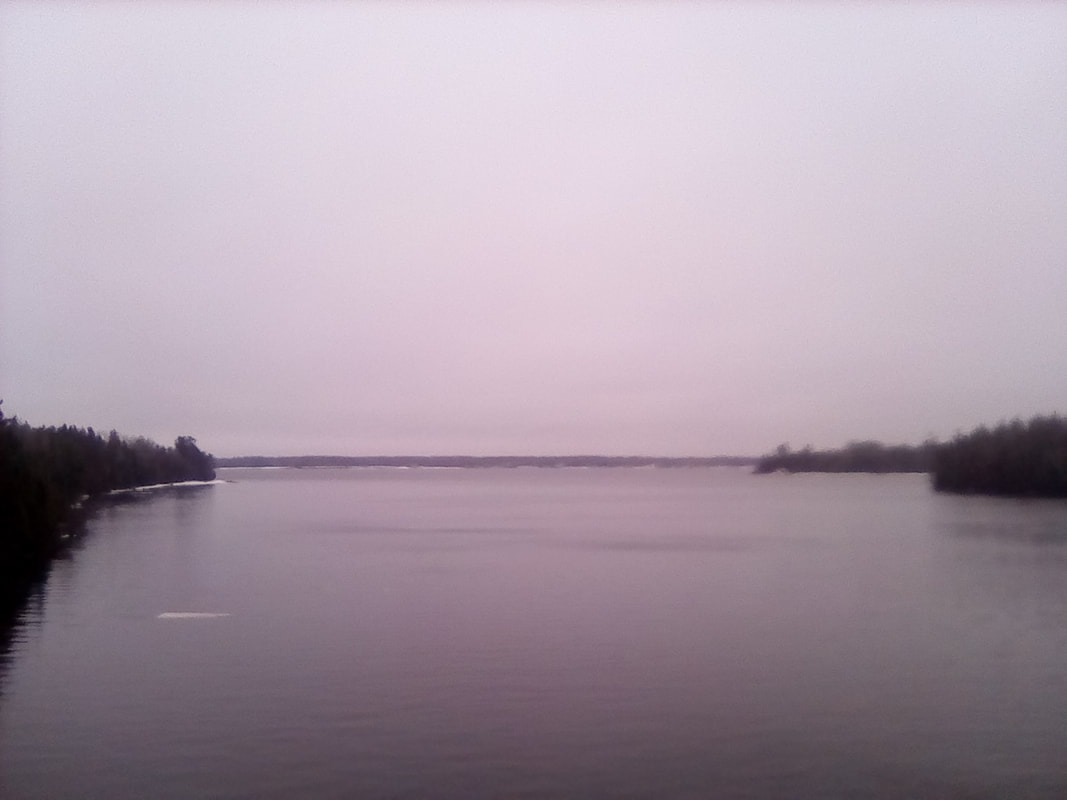 This river is huge 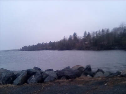 Seems like a good lunch spot Seems like a good lunch spot After that, I headed back south along the highway. I passed the Old Macdonald Farm, (e-i-e-i-o) which was closed for the season. This farm is named after Alexander Macdonald, an early European settler of the area who, surprisingly, built a farm. Now, the farm is a museum showing early 19th Century life, from costumed tour guides to traditional crafts and animal husbandry. The season here opened in June, whereas most places seem to open the end of April onto May. I was disappointed, I wanted to learn about 19th Century life. A little way on from the farm was Gordon’s Wharf, again closed for the season (boat hire and similar), but I could walk down to the river which seemed a great place for lunch, if a little windy. I ate with a good view of the river in both directions and Chatham on the east bank. Yes, like Nova Scotia, New Brunswick is plagued with English place names. After a quick stop back at the AirBnB, I continued heading south on the highway towards Chatham. Although parts of Chatham were almost opposite the AirBnB, the lack of bridges over the river (two in total) meant I had to walk half way back to town to cross the river at the Centennial Bridge, so named because it was built in 1967, the hundredth anniversary of Canadian independence. It was a very green bridge, and it wasn’t until I started to cross said bridge I began to realise how big the Miramichi was. I stopped most of the way across because the big green 'middle' wasn’t central to take some amazing pictures. The view from the bridge was stunning. Although the sky was darkening with the threat of rain, I could still see reasonably far. To the south was downtown Miramichi, I could see a drug mart (presumably a pharmacy), Canadian Tire (so we now know tyres are spelt the American way here) and the ever present golden arches of a McDonald’s. Of course. To the north the Miramichi flows all the way to the Atlantic (not that I could see the Ocean). There was the tree-covered Middle Island where Irish immigrants fleeing the potato famine in the 1840s were detained in quarantine before being allowed into the rest of Canada.
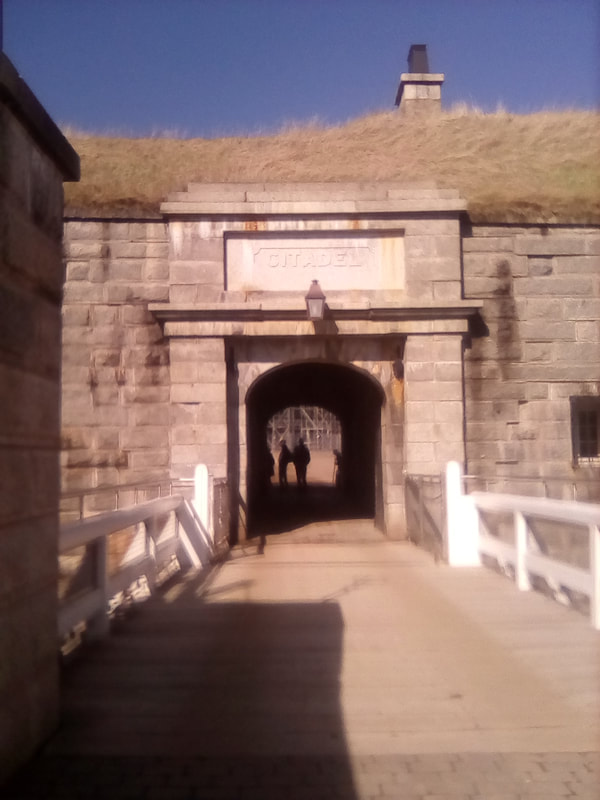
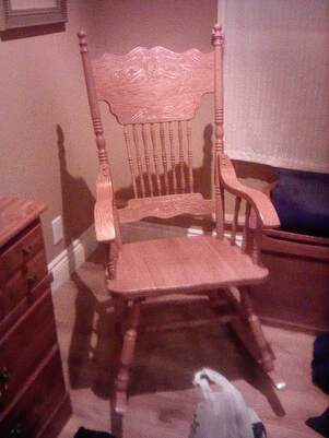 I really liked this rocking chair I really liked this rocking chair I walked a little closer to the Chatham side of the river where I got an excellent aerial view of this area of Miramichi. The city of Miramichi, as my helpful train neighbour had told me, is a collection of incorporated towns including Chatham and Newcastle and so allowing the city to span the river. Overlooking Chatham, I could see St Anne’s church, residential houses, a rusting piece of metal I think was used for launching ships and a disused railway track. At least I presume it was disused, it was very rusty. As I could see all I wanted to see in Chatham well enough from the bridge and the sky was getting darker, I decided now might be a good time to head back to the AirBnB. Around half way back, it started to rain quite heavily. Although the intensity varied, it did keep raining until I got back to the AirBnB, my raincoat thoroughly soaked. At least I knew it was waterproof, my hoodie was only wet around the zip where it was partly open and my t-shirt was dry. The same, unfortunately, cannot be said for my jeans, boots and socks. So I left my clothes on the radiator and settled down in my PJs for a relaxing evening. I’ve crammed in nearly six hours walking, covering over thirty kilometres today, I think I’ve earnt a rest. Tomorrow is another day exploring Miramichi and then my first night train of this trip onto Montréal. Until then, folks, Charlie  So many blankets, but no duvet? 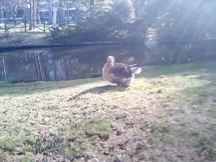 Goose type? Any guesses? Goose type? Any guesses? Hello, all! So, after a few hours sleep, I was once again awake and ready to explore Halifax. When I’d arrived last night, it has been dark, so I could actually see what I was walking passed now. My first stop was the Government House, where Nova Scotia's Lieutenant governor (whatever that might be) lives. At this time of year, it was closed and the gardeners were busy at work, so I only got to admire the Georgian façade before moving on to the Victorian public gardens. Here I saw a very feathery goose (research will be needed to determine which type of goose this was) and from here I walked up a reasonably steep hill to the Halifax citadel. On reaching the top, I discovered a road ringed the star shaped fortress, which was unexpected. There was renovation work going on here too and it seemed like the citadel was also closed for the season. I was happy to walk around the outside, admiring the view of the city, but at the citadel's main entrance, I realised it was partially open. I could explore the grounds, the battlements and a few open rooms. There were very many cannons of different vintages as well as what looked like ship's masts stuck in the ground. I think they were used for signalling, but what exactly they were signalling or to whom, I don’t know.
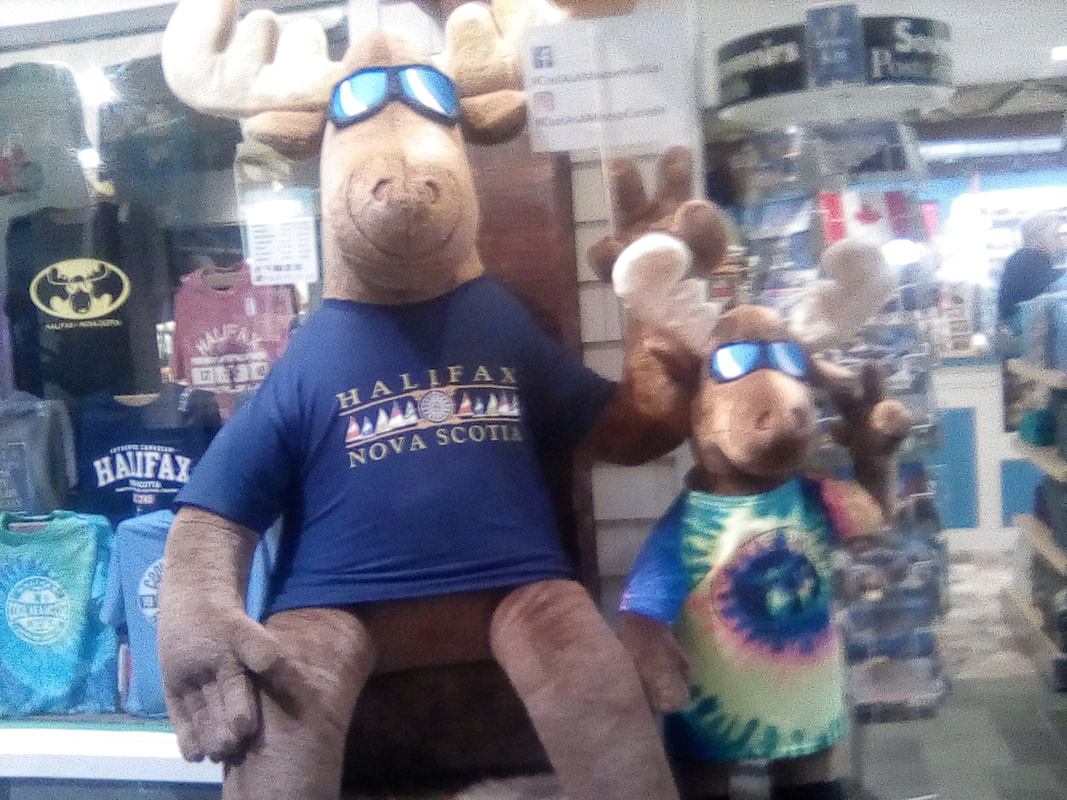
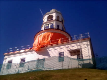 Tick tock... Tick tock... From here I left the citadel and stood at a helpfully placed panorama spot which told me many things. One event which happened in view of this spot was the biggest human-made explosion before the atom bomb in 1917 when a Norwegian ship hit a French missile ship in Halifax harbour. The resulting explosion killed 1600 people, more Nova Scotians than were killed in all the Western front battlefields. I could also see Georges Island, on which more later, and the Old Town Clock. This was gifted by Edward Duke of Kent in 1803 because punctuality, apparently, was his passion. Well, everyone needs a hobby. The clock is the city’s most famous landmark, which was covered in orange tarpaulin while it was being renovated (surprise) and wasn’t actually working, meaning the poor citizens of Halifax couldn’t be on time. I guess they’ll just have to use their smartphones. I stopped to enjoy the suddenly warm sunshine in a memorial park. As well as take the opportunity to remove my coat and find my sunglasses. Here, in the shadow of the rather fancy city hall building was a monument to fallen peace officers and in front of St Paul’s church was a memorial to the soldiers of WWI and WWII and the Korean War. From here it was onto Province House, which, built from 1811-9, is the oldest government building in Canada. It was here in 1864 meetings took place to determine the formation of an independent Canada. Then it was the Harbour Walk, starting with a collection of old wooden buildings and stone skyscrapers. Here I found a great tourist shop called Cool as a Moose. Naturally, I had to check this out. Unsurprisingly, there was a lot of moose toys and t-shirts.
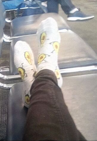
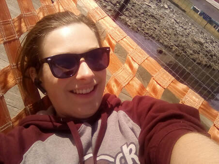 Hammock anyone? Hammock anyone? Then, it was back along the harbour front to enjoy the views. Here, there was a statue commemorating the contribution of Lebanese migrants to Canada and a statue relating the story of Arcadians expelled by the British from Nova Scotia. Some were imprisoned on the tiny and wholly inadequate Georges Island. And then I found a collection of bright orange hammocks. I don’t know why, but whatever they were doing there, they were very comfy! My last stop was Pier 21, now a museum, it was once the entry point for many immigrants arriving in Canada from all over the world, particularly Europe after WWII. Well, I guess I was just another European immigrant seeking a better life at this point. Here, there were plaques commemorating the contribution of some of these people and more general explanations of the arrival stories. 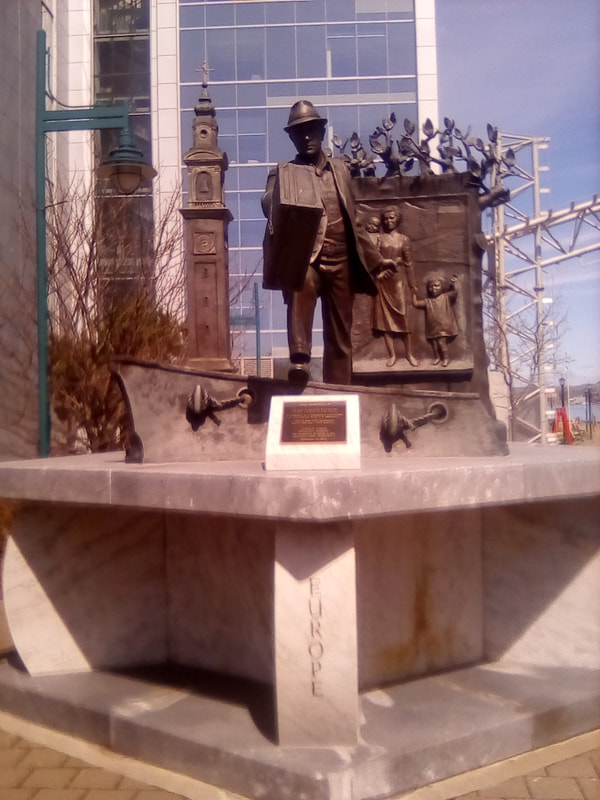 Welcome to Canada! 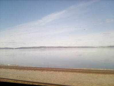 Water, but to my disappointment, not the Atlantic Ocean Water, but to my disappointment, not the Atlantic Ocean It was now time to head back to the hostel to pick up my giant hiking bag from storage and then take the short walk to the station. Here I boarded my first train which will take me through Nova Scotia into New Brunswick for my second city, Miramichi, which through talking to a few Canadians, I’ve learnt is pronounced Mira-mi-shee. So, as I take the train across Nova Scotia, I’ll tell you what I’ve learnt about this province and Canada in general so far. Firstly, Canadians really are as nice as everyone says they are. Both my plane neighbours, someone on the bus, my train neighbour and someone in the queue for the plane toilet were all happy to talk to me. In fact, my train neighbour was an excellent source of Canadian information. I’ve learnt dollars are almost never called bucks in Nova Scotia, but 25, 10 and 5 cent coins are called quarters, dimes and nickels. In most cases, Canadians have more similarities to American than British English. Wind turbines are confusingly called windmills, what windmills are called, I don’t know. More knowledge, although Nova Scotia means New Scotland, the town’s are more often named after English towns – Truro, Halifax, Dartmouth (pronounced Dart-Mouth) and Yarmouth (I don’t know how that’s pronounced), Oxford, Windsor, however there is the Irish influence of Londonderry, Waverly is the closest I’ve seen to a Scottish name (Edinburgh station is called Waverly) and there’s Sydney for a bit of Australian too. Pick up trucks are everywhere, something I’m very happy with, as is the smell of weed. Despite Québec being the French province, Atlantic Canada (New Brunswick, Nova Scotia and Prince Edward Island) have a sizeable French speaking population. Nova Scotia has a lot of trees, almost all the scenery the train has passed has so far been trees. If not, a river or lake. The town’s are sparsely populated with large houses built on open lots. There’s a lot of wooden clapboard houses, painted in a huge variety of colours. The train crossed into New Brunswick shortly after its final Nova Scotia stop at Amherst, at Moncton my helpful neighbour disembarked and I now continue my journey on to Miramichi alone. Where I can try to remember how to pronounce it properly. About an hour after Moncton, as I was enjoying another (cold) boil in the bag meal, this time with Ritz crackers, the train passed a road sign warning of moose for 25km. Unfortunately I was so excited by the sign I froze and by the time I moved to take a picture, it was long gone. Who knows what will happen if I actually see a moose! Sadly I didn’t see any moose at all and the train arrived in Miramichi right on time. My AirBnB host kindly met me at the station, saving me a two and a half hour walk. Miramichi might be a small city, but it’s well spaced out along the river of the same name, with big buildings on acre sized plots of land. I’ve decided I like it. But I’ve still not caught up on sleep from yesterday yet so no time to explore tonight, that’s what I’ll be doing for the next two days. Until then, folks, Charlie  Province 1: Nova Scotia 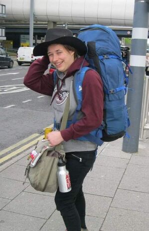 Goodbye, UK! Yes, I'm exactly as tired as I look in that picture... Goodbye, UK! Yes, I'm exactly as tired as I look in that picture... Hello all! I’m currently at Toronto Pearson airport awaiting my connecting flight to Halifax, so now seems a good time to catch you up on my adventures so far. As all these trips seem to, this one started early, leaving the house at 6:45am with Mum once again being my taxi. Seeing as my car broke down on Sunday she’s been my taxi quite a lot recently. So after four hours' sleep, having only finished my last shift at 1am, we were on the road to Gatwick. Although stuck in a bit of traffic, we arrived in plenty of time to check in my giant hiking bag because this trip isn’t one I can just do with hand luggage, and get through security, setting the scanner off because I foolishly wore jeans with zips on the pockets (probably). Still, there was plenty of time for breakfast at Wagas, the full vegan naturally and then it was on to the gate. We were quickly onto the plane and although we were all set to take off early, we then got stuck on the runway and ended up taking off fifteen minutes late. The plane was the largest I’ve been on since I flew to Florida, which would make sense as that was the last time I flew long haul. And that was long before the start of Tails. This plane had two aisles and seven seats although an odd naming convention which missed out G, I and J meant that I was in seat K, the seventh seat. At least I was next to the window. Anyway, we finally took off and although my plan had been to sleep through the majority of the seven and a half hour flight, I woke up after only an hour and consigned myself to spending the rest of the flight awake. I set my watch (well, tablet clock) to Halifax time (Atlantic time, four hours behind the UK) and tried to reset my body clock. Hopefully having worked nights for the last six months means I won’t be too badly affected by jet lag. WestJet, a company I’d never heard of before this trip but who are apparently Canada's number one airline according to Trip Advisor, gave us complimentary coffee, Lotus biscuits and pretzels. OK, so they weren’t free but were included in the price of the ticket. Either way, I wasn’t saying no to food. The flight passed reasonably quickly and as WestJet had allowed eight and a half hours for the flight, we technically landed half an hour early, but by the time we were allowed off, it was more like quarter of an hour. After that it was on to customs, a process much more long winded than my usual travels into Europe. First I had to answer some questions- how long was I staying, was I bringing in illicit goods etc – and have my passport scanned by a machine which in return gave me a mostly incomprehensible slip of paper. After walking through a reasonably fast moving queue, I had to show this paper to a customs official. After that I was free to enter Canada. Although as I’m connecting to Halifax I’ve yet to actually step outside in Canada. WestJet very helpfully transfer bags from Gatwick so I didn’t have to worry about collecting my bag and then checking it back in. Instead I headed upstairs to go through security all over again. 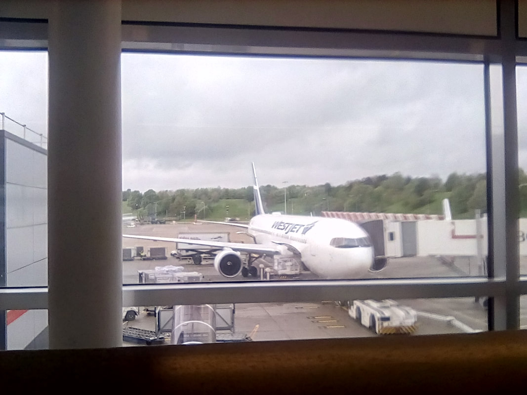 The adventure begins 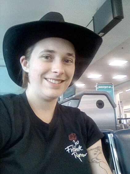 First selfie in Canada. If you look closely at my left arm, you can see Toronto First selfie in Canada. If you look closely at my left arm, you can see Toronto From leaving the Gatwick-Toronto plane at 2:50pm Eastern time, I had over three and a half hours until my Toronto-Halifax flight. After security it was two and a half hours. So I’ve started to write up today’s Tail, whilst wearing my funky avocado socks, a leaving present from the Cattery. I also took the opportunity for a first selfie in Canada, although as I’m in the airport, it’s not the most inspiring of places. Never mind, I’m wearing my Stetson so everything is fine! Maybe the jet lag is affecting me more than I thought as I was convinced my camera had somehow made a mirror image of my world tattoo. It wasn’t until I realised the writing on my t-shirt was the right way round that I worked out Canada wasn’t reversed... Anyway I’ve now got two hours until my flight so I’m going to have a walk around the airport (sitting still for long periods of time as has been mentioned in previous Editions is not my strong point). I’ll catch you up on my journey to Halifax once I’ve arrived there and will actually have set foot on the Canadian soil of Nova Scotia. I’ll be back in Toronto in a few days but until then the airport's nice! Well, as it turns out, there wasn’t actually very far to walk before I ended up back at security so I checked out the Canadian tourist shops instead. Here you can buy a medium sized moose for $50 (£30) or a large maple leaf shaped bottle of maple syrup for about the same price. In the great debate over whether Canadians speak British or American English or have their own Canadian English (something I’ve still not got round to researching), I’ve discovered public toilets are called washrooms and travelators are called moving sidewalks. In my mind that puts them closer to American. And speaking of washrooms, in the airport, Canadian cubicles copy Americans and have walls starting a foot above the ground and doors with such a big gap around the edge you can definitely see out if not see in. Is this a money saving initiative?
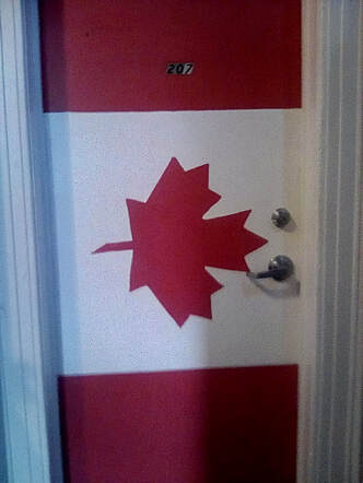 I'm staying in the Canada room! I'm staying in the Canada room! Anyway, I returned to the gate to discover my flight had been delayed. Ah, this is more like the flights I’m used to. At this point I wasn’t too worried about the delay, I was reading my Canada travel guide book. Finally the cabin crew had cleared customs (the previous flight had just come in from Orlando) and we were allowed to board. The plane took off nearly an hour late which I wasn’t too happy about as by this point I had definitely missed the bus which would take me from the airport into the city. I’d have to get the 11:15 instead of the 10:15 bus meaning I wouldn’t get to the hostel until after midnight. Because of time difference, I’d be awake for over twenty four hours.
But at least I had another bus, the more pressing issue was the forty odd passengers who had a connecting flight and all seemed to be sitting near me. At the time, I thought they were going to St John's, Newfoundland but I’ve since learnt there’s a St John, New Brunswick so it could have been either. Their connecting flight, wherever it was going was delayed too. I don’t know if they made their flight, but after what seemed like a very quick one hour forty five minute flight, I had definitely missed my bus. The flight landed at 9:50pm and although there was no security (internal flight), it was after 10:15 before the bags started to come off the carousel. Seemingly everyone else’s bag came off the carousel until only a few people were left waiting. Couple this with the fact I hadn’t seen my bag since Gatwick this morning, this lead to an anxious wait. What if it hadn’t been transferred from Toronto? Finally, and genuinely one of the last to be released, my bag appeared through those rubber curtain things that are probably made of plastic. It meant I’d well and truly missed the 10:15 bus. By the time I had made it to the bus stop, I had forty minutes to wait. As it was slightly snowing, I headed back inside and ate my dinner. I hadn’t realised my bag would be transferred for me and so I hadn’t packed my boil in the bag meal in my hand luggage. Good thing I had lots of snacks and more pretzels on the plane. The 320 bus arrived and departed right on time (good) and I was soon on my way to Dartmouth where I would change to get the number 1 bus. I kept falling asleep (twenty four hours since I woke up this morning) but I didn’t miss my stop, the bus was early and I ended up getting an earlier number 1 than Google maps said I should. Unfortunately the ticket machine didn’t give change, the ticket was $2.50 and only having $1.50 in change, I had to sacrifice a $5 note (or bill as I suspect they might be called here). This bus was also on time and I arrived at the hostel only five minutes after the reception closed at midnight. This might have been a problem, but one of the staff members came back and although being off duty and slightly drunk kindly checked me in. By the time I had got sorted and let several people know I had arrived in Halifax, Nova Scotia being a responsible traveller, it was after 1am when I could finally sleep. I was exhausted! Anyway, I’ll be exploring Halifax tomorrow and then I’ll the on to Miramichi. Until then, folks Charlie Hello, all! So, here I am, about to embark on my greatest adventure yet, the land of moose, maple syrup and ice hockey. Yes, I’m off to Canada. My regular readers may have noticed that this Edition of Tails is coming to you from my (Charlie’s) perspective. It was a difficult decision, but I have had to leave Chesh, my erstwhile travelling companion behind, mostly due to the space restraints of fitting an admittedly quite large fluffy cat into my bag as I plan to cross a country the size of Europe. I will try to keep to the original tone of the blog and of course will keep with it in the spirit with which it was originally created. And I’m keeping the name, Tails of a Travelling Cat, as I’m sure you’re well aware of my love of and affinity towards felines. This trip is very ambitious, in two weeks and a half weeks, I plan to travel west across the entire country of Canada, covering eight provinces, one US state, two oceans (sort of), Atlantic Canada, the prairies, the Badlands and the Rocky Mountains. And then, when I’ve run out of west, I’m heading north up into the Chilcotin Mountains. Well, I’ve always liked a challenge. My trip will begin in Halifax, Nova Scotia (with a slight detour via Toronto due to the severe shortage of direct flights to Halifax – one a month), right on the Atlantic Ocean. I am travelling by train (my preferred mode of transport), using Via Rail. From Halifax, I’m visiting Miramichi, New Brunswick, where I will explore the beautiful Miramichi River. Then I will be exploring the cities of Montréal, Quebec and Toronto, Ontario, with a day trip to Niagara Falls, hopefully crossing the border into New York State and the US. After a brief visit to Winnipeg, Manitoba, it’s on to Saskatoon, Saskatchewan, prairie country, where I’ll meet my long-time travel buddy, Jack. Based in Saskatoon for a few days, we’re hiring a pickup truck (!) and taking a couple of road trips, across the Badlands and to the Prince Albert National Park. After Saskatoon, we travel on to a short stop in Jasper, Alberta, before spending the night in Prince George, British Columbia, before taking the train back to Jasper. From here, we’ll cram in as much hiking around the National Park as we can. Jasper and Prince George are both firmly in the Rockies, and from here we’ll travel on to Vancouver, British Columbia. With only a day here, it’ll be a quick explore of the city and hopefully a visit to a gigantic suspension bridge high over a canyon. Unfortunately, Vancouver Island slightly got in the way of us reaching the Pacific, and, with only one day in the city and the Island being rather larger than I realised at first, it looks like we’ll have to make do with English Bay instead. Maybe another time I’ll officially make it to the Pacific Ocean. After Vancouver, Jack flies home and I continue up into the Chilcotin Mountains, a place so remote, you can’t even see what it looks like on Google Maps. From here, I will attempt to continue publishing the blog, but out in the Canadian wilderness (true moose, bear and wolf territory), I can’t guarantee internet reliability. 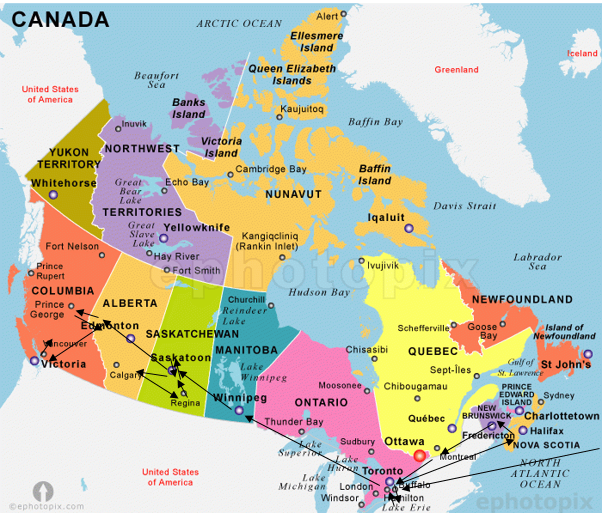 I’ve got some long train journeys (the longest being 35 hours) so some of my blog might get posted while I’m travelling. Keep tuned to Facebook as I’ll be posting the links there as normal.
Until then, folks Charlie |